
فائل:Gales Bay.jpg
اس نمائش کا حجم: 800 × 536 پکسلز۔ دیگر تصمیمات: 320 × 214 پکسلز | 640 × 429 پکسلز | 1,024 × 686 پکسلز | 1,280 × 857 پکسلز۔
اصل فائل (1,280 × 857 پکسل، فائل کا حجم: 146 کلوبائٹ، MIME قسم: image/jpeg)
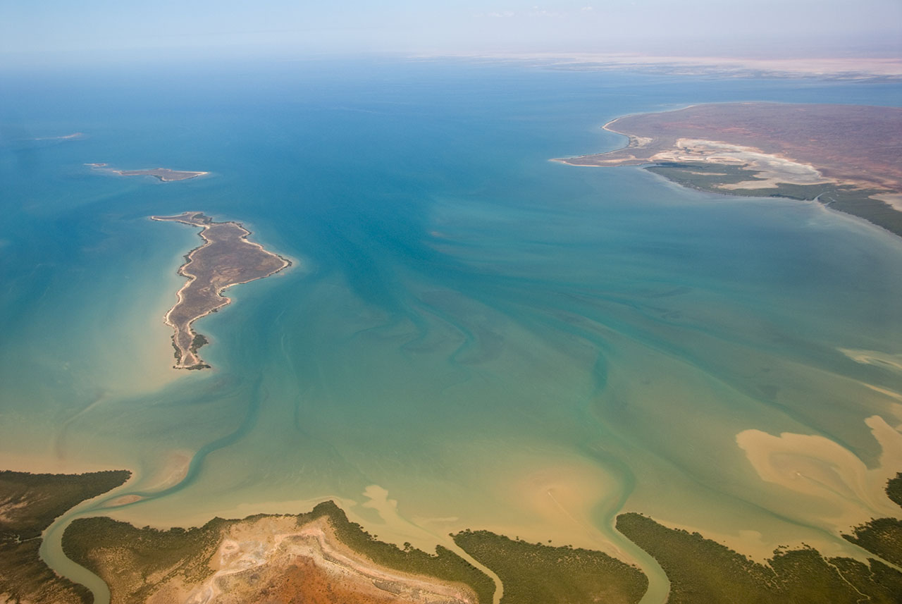
| تفصیل | This is an aerial photograph of Gales Bay, a bay at the south end of Exmouth Gulf, Western Australia. The nearest foreground is Doole Island; behind it is Roberts Island; the further island is possibly Whitmore Island. The land on the right is the Sandalwood Peninsula. In the top right hand corner some of Giralia Bay can just be seen; across the top can be seen the continuing coastline of Western Australia. |
| تاریخ | |
| ماخذ | https://www.flickr.com/photos/61952179@N00/366312114/ |
| مصنف | Jon Hanson |
| اجازت (فائل کا دوبارہ استعمال) |
This file is licensed under the Creative Commons Attribution-Share Alike 2.0 Generic license.
|
| Camera location | | View this and other nearby images on: OpenStreetMap |
|---|
| This image, originally posted to Flickr, was reviewed on 18 May 2008 by the administrator or reviewer Kanonkas, who confirmed that it was available on Flickr under the stated license on that date. |
فائل کا تاریخچہ
کسی خاص وقت یا تاریخ میں یہ فائل کیسی نظر آتی تھی، اسے دیکھنے کے لیے اس وقت/تاریخ پر کلک کریں۔
| تاریخ/وقت | تھمب نیل | ابعاد | صارف | تبصرہ | |
|---|---|---|---|---|---|
| رائج الوقت | 12:20، 18 مئی 2008ء | | 1,280 × 857 (146 کلوبائٹ) | Hesperian | {{Information |Description=This is an aerial photograph of Gales Bay, a bay at the south end of Exmouth Gulf, Western Australia. The island in the foreground is Doole Island; behind it is Roberts Island; the further island is ''possibl |
روابط
درج ذیل صفحہ اس فائل کو استعمال کر رہا ہے:
فائل کا عالمی استعمال
مندرجہ ذیل ویکیوں میں یہ فائل زیر استعمال ہے:
- ar.wikipedia.org پر استعمال
- arz.wikipedia.org پر استعمال
- ceb.wikipedia.org پر استعمال
- de.wikipedia.org پر استعمال
- en.wikipedia.org پر استعمال
- fi.wiktionary.org پر استعمال
- lt.wikipedia.org پر استعمال
- nl.wikipedia.org پر استعمال
- pnb.wikipedia.org پر استعمال
- www.wikidata.org پر استعمال