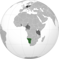
فائل:German sw africa map.png

اس نمائش کا حجم: 600 × 600 پکسلز۔ دیگر تصمیمات: 240 × 240 پکسلز | 480 × 480 پکسلز | 768 × 768 پکسلز | 1,024 × 1,024 پکسلز | 2,000 × 2,000 پکسلز۔
اصل فائل (2,000 × 2,000 پکسل، فائل کا حجم: 602 کلوبائٹ، MIME قسم: image/png)
فائل کا تاریخچہ
کسی خاص وقت یا تاریخ میں یہ فائل کیسی نظر آتی تھی، اسے دیکھنے کے لیے اس وقت/تاریخ پر کلک کریں۔
| تاریخ/وقت | تھمب نیل | ابعاد | صارف | تبصرہ | |
|---|---|---|---|---|---|
| رائج الوقت | 15:46، 10 فروری 2023ء |  | 2,000 × 2,000 (602 کلوبائٹ) | Goran tek-en | Added border of South Sudan as requested by Maphobbyist |
| 15:30، 6 اپریل 2013ء |  | 2,000 × 2,000 (596 کلوبائٹ) | OgreBot | (BOT): Reverting to most recent version before archival | |
| 15:30، 6 اپریل 2013ء |  | 2,000 × 2,000 (596 کلوبائٹ) | OgreBot | (BOT): Uploading old version of file from en.wikipedia; originally uploaded on 2010-06-02 20:50:38 by VoodooIsland | |
| 15:30، 6 اپریل 2013ء |  | 2,000 × 2,000 (595 کلوبائٹ) | OgreBot | (BOT): Uploading old version of file from en.wikipedia; originally uploaded on 2010-06-02 20:49:01 by VoodooIsland | |
| 11:14، 5 اپریل 2013ء |  | 2,000 × 2,000 (596 کلوبائٹ) | File Upload Bot (Magnus Manske) | Transfered from en.wikipedia by User:misha motsniy using CommonsHelper |
روابط
درج ذیل صفحہ اس فائل کو استعمال کر رہا ہے:
فائل کا عالمی استعمال
مندرجہ ذیل ویکیوں میں یہ فائل زیر استعمال ہے:
- af.wikipedia.org پر استعمال
- ar.wikipedia.org پر استعمال
- ast.wikipedia.org پر استعمال
- az.wikipedia.org پر استعمال
- be.wikipedia.org پر استعمال
- cs.wikipedia.org پر استعمال
- el.wikipedia.org پر استعمال
- he.wikipedia.org پر استعمال
- hi.wikipedia.org پر استعمال
- it.wikipedia.org پر استعمال
- li.wikipedia.org پر استعمال
- lt.wikipedia.org پر استعمال
- mr.wikipedia.org پر استعمال
- nl.wikipedia.org پر استعمال
- simple.wikipedia.org پر استعمال
- uk.wikipedia.org پر استعمال
- vi.wikipedia.org پر استعمال
- www.wikidata.org پر استعمال
