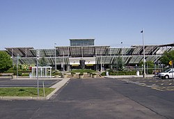
ٹی ایف گرین ہوائی اڈا
| ٹی ایف گرین ہوائی اڈا Theodore Francis Green Memorial State Airport | |||||||||||||||
|---|---|---|---|---|---|---|---|---|---|---|---|---|---|---|---|
 | |||||||||||||||
 | |||||||||||||||
| خلاصہ | |||||||||||||||
| ہوائی اڈے کی قسم | عوامی | ||||||||||||||
| مالک | State of Rhode Island | ||||||||||||||
| عامل | Rhode Island Airport Corporation | ||||||||||||||
| خدمت | پروویڈنس، روڈ آئلینڈ | ||||||||||||||
| محل وقوع | 2000 Post Road واروک، روڈ آئلینڈ, Rhode Island | ||||||||||||||
| فوکس شہر برائے | Norwegian Air International | ||||||||||||||
| بلندی سطح سمندر سے | 55 فٹ / 17 میٹر | ||||||||||||||
| متناسقات | 41°43′26″N 071°25′42″W / 41.72389°N 71.42833°W | ||||||||||||||
| ویب سائٹ | www | ||||||||||||||
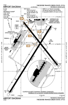
| نقشہs | |||||||||||||||
 FAA diagram | |||||||||||||||
| لوا خطا ماڈیول:Location_map میں 525 سطر پر: Unable to find the specified location map definition: "Module:Location map/data/USA Rhode Island" does not exist۔Location in Rhode Island | |||||||||||||||
| رن وے | |||||||||||||||
| |||||||||||||||
| اعداد و شمار (2015, 2016) | |||||||||||||||
| |||||||||||||||
ماخذ: فیڈرل ایوی ایشن ایڈمنسٹریشن, | |||||||||||||||
ٹی ایف گرین ہوائی اڈا (انگریزی: T. F. Green Airport) ریاستہائے متحدہ امریکا کا ایک ہوائی اڈا جو روڈ آئلینڈ میں واقع ہے۔[1]
مزید دیکھیے[ترمیم]
حوالہ جات[ترمیم]
- ↑ انگریزی ویکیپیڈیا کے مشارکین۔ "T. F. Green Airport"
بیرونی روابط[ترمیم]
- ہوائی اڈوں کے بارے میں معلومات
- -نماياں-ہوائی-اڈے-کون-سے -رہے/g-42455746 2017ء ميں يورپ و مشرق وسطٰی کے نماياں ہوائی اڈے کون سے رہے
سانچہ:روڈ آئلینڈ میں ہوائی اڈے
|
|
