
فائل:Belgium - Location Map (2013) - BEL - UNOCHA.svg

اصل فائل (ایس وی جی فائل، ابعاد 254 × 254 پکسل، فائل کا حجم: 905 کلوبائٹ)
_-_BEL_-_UNOCHA.svg)
خلاصہ
| تفصیل |
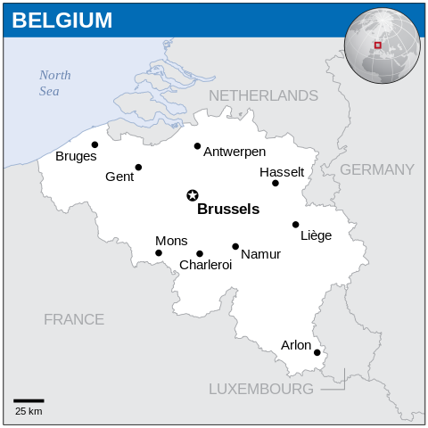
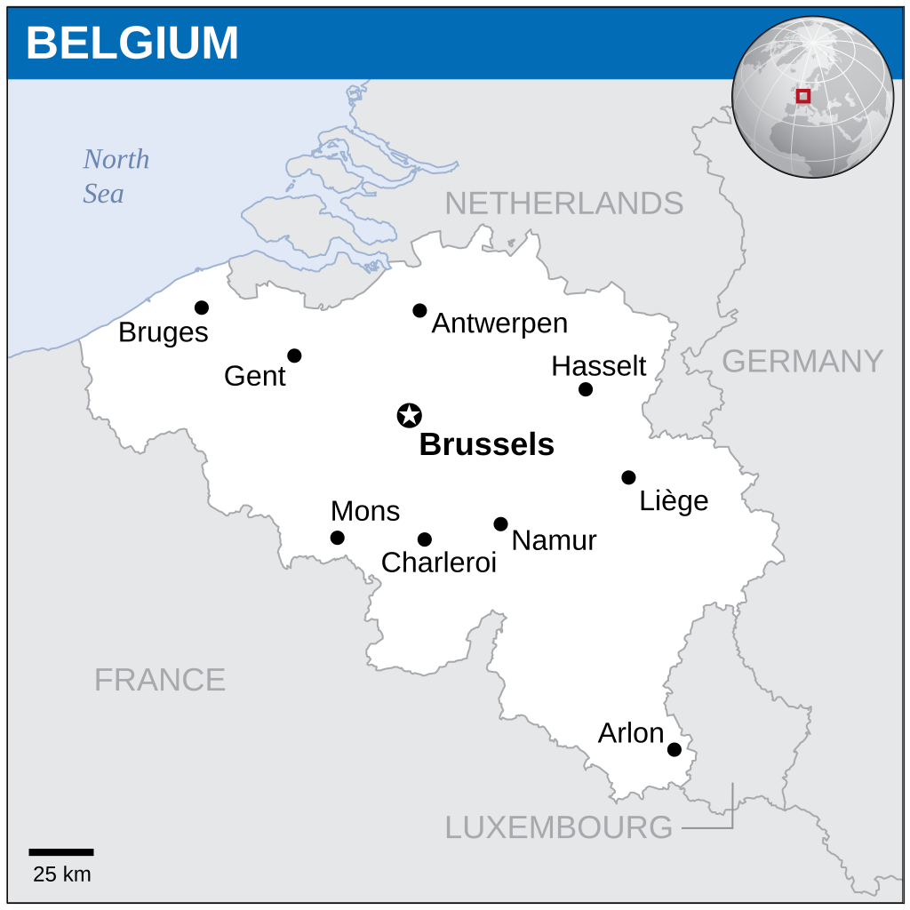
English: Locator map of Belgium. |
| تاریخ | |
| ماخذ |
English: Belgium Locator Map (ReliefWeb), ESRI, UNCS |
| مصنف | |
| SVG genesis |
اجازہ کاری
- آپ آزاد ہیں:
- شیئر کرنے – کام کو نقل، تقسیم یا منتقل کرنے کے لیے
- ریمکس کے لیے – کام منبطق کرنے کے لیے
- مندرجہ ذیل شرائط کے تحت:
- انتساب – آپ کو اس کام کا انتساب مصنف یا اجازت دہندہ کے بتائے گئے طریقہ کے مطابق دینا ہوگا (تاہم یہ انتساب اس طرح نہیں ہونا چاہیے کہ اسے دیکھ کر ایسا محسوس ہو کہ اصل مصنف یا اجازت دہندہ آپ کے یا آپ کے ذریعہ اس کام کے استعمال کرنے کے حامی ہیں)۔
 This map is part of a collection of 216 free country maps, created by the UN Office for the Coordination of Humanitarian Affairs (OCHA), to be used in print, web or broadcast products.
The ReliefWeb Location Maps released here are maps that highlight a country, its capital, major populated places and the surrounding regions. Attribution Requirements
Using the map without modifications: ensure that the sources and the disclaimer are below the map. Credit as follows: "Credit: OCHA". For use with alteration: remove the OCHA logo and disclaimer following any modification to the map, but keep the data sources as mentioned below the map. Credit the modified map as follows: "Based on OCHA map". You are responsible for the content of your map. We are keen to receive your feedback and hear how you used OCHA's maps. We would be grateful if you would notify us by e-mail and share your work with us. UN Disclaimer
The designations employed and the presentation of material of this map do not imply the expression of any opinion whatsoever on the part of the Secretariat of the United Nations concerning the legal status of any country, territory, city or area or of its authorities or concerning the delimitation of its frontiers or boundaries. |
فائل کا تاریخچہ
کسی خاص وقت یا تاریخ میں یہ فائل کیسی نظر آتی تھی، اسے دیکھنے کے لیے اس وقت/تاریخ پر کلک کریں۔
| تاریخ/وقت | تھمب نیل | ابعاد | صارف | تبصرہ | |
|---|---|---|---|---|---|
| رائج الوقت | 17:21، 4 فروری 2024ء | | 254 × 254 (905 کلوبائٹ) | Illchy | File uploaded using svgtranslate tool (https://svgtranslate.toolforge.org/). Added translation for id. |
| 19:33، 7 نومبر 2014ء |  | 254 × 254 (904 کلوبائٹ) | GermanJoe | watermark removed | |
| 22:26، 13 مارچ 2014ء |  | 254 × 254 (948 کلوبائٹ) | UN OCHA maps bot | == {{int:filedesc}} == {{Information |description={{en|1=Locator Map of Belgium. {{OCHA map}}}} |date=2013 |source=[http://reliefweb.int/map/belgium/belgium-location-map-2013 Belgium Locator Map (ReliefWeb)] |author=[[w:United Nations Off... |
روابط
درج ذیل صفحہ اس فائل کو استعمال کر رہا ہے:
فائل کا عالمی استعمال
مندرجہ ذیل ویکیوں میں یہ فائل زیر استعمال ہے:
- az.wiktionary.org پر استعمال
- ban.wikipedia.org پر استعمال
- bh.wikipedia.org پر استعمال
- csb.wikipedia.org پر استعمال
- es.wikipedia.org پر استعمال
- eu.wikipedia.org پر استعمال
- fa.wikipedia.org پر استعمال
- id.wikipedia.org پر استعمال
- incubator.wikimedia.org پر استعمال
- ka.wikipedia.org پر استعمال
- min.wikipedia.org پر استعمال
- mk.wikipedia.org پر استعمال
- ml.wikipedia.org پر استعمال
- mwl.wikipedia.org پر استعمال
- sco.wikipedia.org پر استعمال
- sh.wikipedia.org پر استعمال
- simple.wikipedia.org پر استعمال
- so.wikipedia.org پر استعمال
- te.wikipedia.org پر استعمال
- trv.wikipedia.org پر استعمال
- zh.wikipedia.org پر استعمال
_-_BEL_-_UNOCHA.svg)