
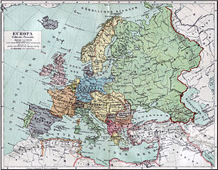
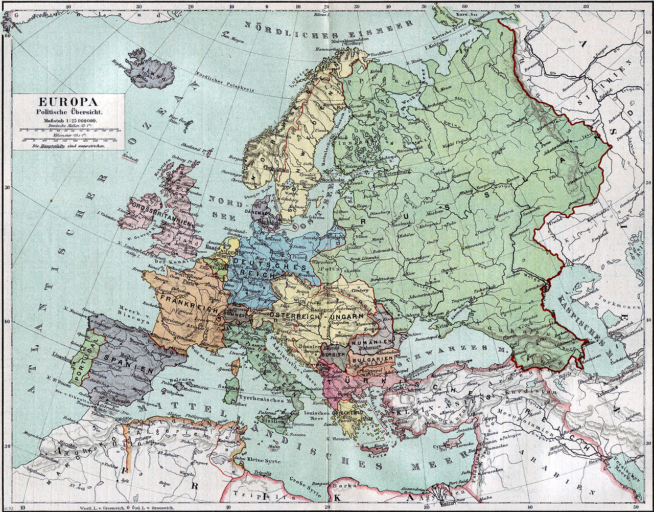
فائل:Europa 1890.jpg

اس نمائش کا حجم: 766 × 599 پکسلز۔ دیگر تصمیمات: 307 × 240 پکسلز | 614 × 480 پکسلز | 982 × 768 پکسلز | 1,280 × 1,001 پکسلز | 2,500 × 1,956 پکسلز۔
اصل فائل (2,500 × 1,956 پکسل، فائل کا حجم: 1.84 MB، MIME قسم: image/jpeg)
خلاصہ
| وضاحت |
Politische Karte Europas ca. 1890 |
|||||
| تاریخ | ||||||
| ماخذ | Meyers Kleines Konversationslexikon. Fünfte, umgearbeitete und vermehrte Auflage. Bd. 1. Bibliographisches Institut, Leipzig und Wien 1892. | |||||
| خالق |
unbekannt, scan by sidonius 15:36, 7 November 2006 (UTC) |
|||||
| اجازت (فائل کا دوبارہ استعمال) |
|
|||||
| Georeferencing | If inappropriate please set warp_status = skip to hide. | |||||
| دوسرے نسخے | Derivative works of this file: Blank map of Europe 1890.svg |

_en.png)
.png)
.jpg)
فائل کا تاریخچہ
کسی خاص وقت یا تاریخ میں یہ فائل کیسی نظر آتی تھی، اسے دیکھنے کے لیے اس وقت/تاریخ پر کلک کریں۔
| تاریخ/وقت | تھمب نیل | ابعاد | صارف | تبصرہ | |
|---|---|---|---|---|---|
| رائج الوقت | 15:36، 7 نومبر 2006ء | | 2,500 × 1,956 (1.84 MB) | Sidonius | {{Information |Description=Politische Karte Europas ca. 1890 |Source=Meyers Kleines Konversationslexikon. Fünfte, umgearbeitete und vermehrte Auflage. Bd. 1. Bibliographisches Institut, Leipzig und Wien 1892. |Date=1892 |Author=unbekannt, |
روابط
درج ذیل صفحہ اس فائل کو استعمال کر رہا ہے:
فائل کا عالمی استعمال
مندرجہ ذیل ویکیوں میں یہ فائل زیر استعمال ہے:
- bn.wikipedia.org پر استعمال
- de.wikipedia.org پر استعمال
- de.wikibooks.org پر استعمال
- en.wikipedia.org پر استعمال
- et.wikipedia.org پر استعمال
- fa.wikipedia.org پر استعمال
- fr.wikipedia.org پر استعمال
- hu.wikipedia.org پر استعمال
- it.wikipedia.org پر استعمال
- mk.wikipedia.org پر استعمال
- pl.wikipedia.org پر استعمال
- pnb.wikipedia.org پر استعمال
- sa.wikipedia.org پر استعمال
- scn.wikipedia.org پر استعمال
- skr.wikipedia.org پر استعمال
- uk.wikipedia.org پر استعمال