
فائل:Golfo de Vizcaya - BM WMS 2004.jpg

اس نمائش کا حجم: 643 × 600 پکسلز۔ دیگر تصمیمات: 257 × 240 پکسلز | 514 × 480 پکسلز | 823 × 768 پکسلز | 1,060 × 989 پکسلز۔
اصل فائل (1,060 × 989 پکسل، فائل کا حجم: 205 کلوبائٹ، MIME قسم: image/jpeg)
| تفصیل |
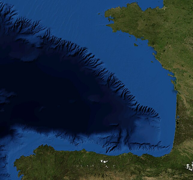
Español: Foto satelital del Golfo de Vizcaya
English: Satellite Picture of the Bay of Biscay |
|||
| تاریخ | ||||
| ماخذ | Satellite pictures, from NASA World Wind Globe, version 1.4 | |||
| مصنف | Serg!o | |||
| اجازت (فائل کا دوبارہ استعمال) |
|

فائل کا تاریخچہ
کسی خاص وقت یا تاریخ میں یہ فائل کیسی نظر آتی تھی، اسے دیکھنے کے لیے اس وقت/تاریخ پر کلک کریں۔
| تاریخ/وقت | تھمب نیل | ابعاد | صارف | تبصرہ | |
|---|---|---|---|---|---|
| رائج الوقت | 12:08، 22 جون 2010ء | | 1,060 × 989 (205 کلوبائٹ) | Serg!o | {{Information |Description={{es|Foto satelital del es:Golfo de Vizcaya}} {{en|Satellite Picture of the en:Bay of Biscay}} |Source=Satellite pictures, from NASA World Wind Globe, version 1.4 |Date=22-07-2010 |Author=Serg!o |Permis |
روابط
درج ذیل صفحہ اس فائل کو استعمال کر رہا ہے:
فائل کا عالمی استعمال
مندرجہ ذیل ویکیوں میں یہ فائل زیر استعمال ہے:
- es.wikipedia.org پر استعمال
- eu.wikipedia.org پر استعمال
- pl.wiktionary.org پر استعمال