
فائل:Iran-Pakistan-India.JPG
اس سے زیادہ ریزولیوشن دستیاب نہیں۔
Iran-Pakistan-India.JPG (358 × 316 پکسل، فائل کا حجم: 32 کلوبائٹ، MIME قسم: image/jpeg)

|
This map image could be re-created using vector graphics as an SVG file. This has several advantages; see Commons:Media for cleanup for more information. If an SVG form of this image is available, please upload it and afterwards replace this template with
{{vector version available|new image name}}.
It is recommended to name the SVG file “Iran-Pakistan-India.svg”—then the template Vector version available (or Vva) does not need the new image name parameter. |


خلاصہ
| تفصیل |
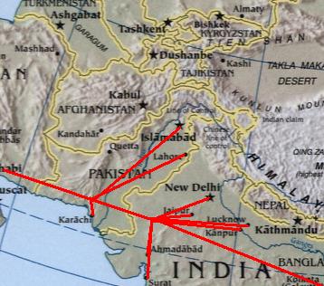
English: Modified :Image:Sino-Indian Geography.png, created and published by the Central Intelligence Agency of the United States of America in 2004. The modified version was released by Deepak Gupta under Public Domain.
فارسی: *برگرفته از ویکی پدیای انگلیسی [1] |
| تاریخ | 16 مارچ 2007 (original upload date) |
| ماخذ | Transferred from en.wikipedia to Commons by User:RaviC using CommonsHelper. |
| مصنف | Deepak at en.wikipedia |
![[1]](https://en.wikipedia.org/wiki/Image:Iran-Pakistan-India.JPG)
اجازہ کاری
| تخلیق کار Deepak at انگریزی ویکیپیڈیا نے اس کام کو دائرہ عام میں شائع کیا ہے جس کا اطلاق عالمی سطح پر ہوتا ہے۔ بعض ملکوں میں یہ قانونی طور پر شاید ممکن نہ ہو؛ اگر ایسا ہے تو: Deepak ہر ایک کو کسی بھی مقصد کے لیے بغیر کسی شرط کے اس تصویر کے استعمال کا حق تفویض کرتا/کرتی ہے، بجز اس صورت کے جس میں کوئی قانونی رکاوٹ موجود ہو۔ |
اولین اپلوڈ کا نوشتہ
فائل کی تفصیلات کا اصل صفحہ یہاں تھا۔ درج ذیل تمام صارفین en.wikipedia کے ہیں۔
- 2007-03-16 10:12 Deepak 358×316× (32721 bytes) <small>Modified [[:Image:Sino-Indian Geography.png]], created and published by the [[Central Intelligence Agency]] of the [[United States of America]] in 2004. The modified version was released by [[User:Deepak gupta|Deepak Gupta]] under Public Domain.</s
فائل کا تاریخچہ
کسی خاص وقت یا تاریخ میں یہ فائل کیسی نظر آتی تھی، اسے دیکھنے کے لیے اس وقت/تاریخ پر کلک کریں۔
| تاریخ/وقت | تھمب نیل | ابعاد | صارف | تبصرہ | |
|---|---|---|---|---|---|
| رائج الوقت | 22:13، 12 نومبر 2008ء | | 358 × 316 (32 کلوبائٹ) | File Upload Bot (Magnus Manske) | {{BotMoveToCommons|en.wikipedia}} {{Information |Description={{en|<small>Modified en::Image:Sino-Indian Geography.png, created and published by the en:Central Intelligence Agency of the en:United States of America in 2004. The modified ver |
روابط
درج ذیل صفحہ اس فائل کو استعمال کر رہا ہے:
فائل کا عالمی استعمال
مندرجہ ذیل ویکیوں میں یہ فائل زیر استعمال ہے:
- ar.wikipedia.org پر استعمال
- bn.wikipedia.org پر استعمال
- en.wikipedia.org پر استعمال
- fa.wikipedia.org پر استعمال
- fr.wikipedia.org پر استعمال
- pnb.wikipedia.org پر استعمال
- ta.wikipedia.org پر استعمال
- uk.wikipedia.org پر استعمال