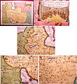
فائل:Iran 1748.jpg

اس نمائش کا حجم: 550 × 600 پکسلز۔ دیگر تصمیمات: 220 × 240 پکسلز | 440 × 480 پکسلز | 806 × 879 پکسلز۔
اصل فائل (806 × 879 پکسل، فائل کا حجم: 218 کلوبائٹ، MIME قسم: image/jpeg)
فائل کا تاریخچہ
کسی خاص وقت یا تاریخ میں یہ فائل کیسی نظر آتی تھی، اسے دیکھنے کے لیے اس وقت/تاریخ پر کلک کریں۔
| تاریخ/وقت | تھمب نیل | ابعاد | صارف | تبصرہ | |
|---|---|---|---|---|---|
| رائج الوقت | 18:09، 5 دسمبر 2011ء |  | 806 × 879 (218 کلوبائٹ) | File Upload Bot (Magnus Manske) | {{BotMoveToCommons|en.wikipedia|year={{subst:CURRENTYEAR}}|month={{subst:CURRENTMONTHNAME}}|day={{subst:CURRENTDAY}}}} {{Information |Description={{en|"L'Empire De Perse" issued 1748, Paris, by Le Rouge. A nicely detailed mid-18th century map of Persia. |
روابط
درج ذیل صفحہ اس فائل کو استعمال کر رہا ہے:
فائل کا عالمی استعمال
مندرجہ ذیل ویکیوں میں یہ فائل زیر استعمال ہے:
- azb.wikipedia.org پر استعمال
- bn.wikipedia.org پر استعمال
- ca.wikipedia.org پر استعمال
- en.wikipedia.org پر استعمال
- fa.wikipedia.org پر استعمال
- fr.wikipedia.org پر استعمال
- it.wikipedia.org پر استعمال
- ko.wikipedia.org پر استعمال
- nn.wikipedia.org پر استعمال
- pnb.wikipedia.org پر استعمال
- tr.wikipedia.org پر استعمال
- www.wikidata.org پر استعمال
