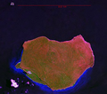
فائل:Mona Landsat7 Pseudo.png

اس نمائش کا حجم: 680 × 599 پکسلز۔ دیگر تصمیمات: 272 × 240 پکسلز | 545 × 480 پکسلز | 690 × 608 پکسلز۔
اصل فائل (690 × 608 پکسل، فائل کا حجم: 1.2 MB، MIME قسم: image/png)
فائل کا تاریخچہ
کسی خاص وقت یا تاریخ میں یہ فائل کیسی نظر آتی تھی، اسے دیکھنے کے لیے اس وقت/تاریخ پر کلک کریں۔
| تاریخ/وقت | تھمب نیل | ابعاد | صارف | تبصرہ | |
|---|---|---|---|---|---|
| رائج الوقت | 18:48، 19 فروری 2007ء |  | 690 × 608 (1.2 MB) | Ratzer | NASA World Wind screen image Landsat 7 Pseudo color Mona Island, Puerto Rico |
روابط
درج ذیل صفحہ اس فائل کو استعمال کر رہا ہے:
فائل کا عالمی استعمال
مندرجہ ذیل ویکیوں میں یہ فائل زیر استعمال ہے:
- arz.wikipedia.org پر استعمال
- br.wikipedia.org پر استعمال
- ca.wikipedia.org پر استعمال
- ceb.wikipedia.org پر استعمال
- cs.wikipedia.org پر استعمال
- el.wikipedia.org پر استعمال
- en.wikipedia.org پر استعمال
- en.wikivoyage.org پر استعمال
- es.wikipedia.org پر استعمال
- et.wikipedia.org پر استعمال
- eu.wikipedia.org پر استعمال
- fa.wikipedia.org پر استعمال
- it.wikivoyage.org پر استعمال
- ja.wikipedia.org پر استعمال
- ko.wikipedia.org پر استعمال
- pl.wikipedia.org پر استعمال
- sv.wikipedia.org پر استعمال
- sw.wikipedia.org پر استعمال
- szl.wikipedia.org پر استعمال
- tr.wikipedia.org پر استعمال
- tt.wikipedia.org پر استعمال
- vec.wikipedia.org پر استعمال
- www.wikidata.org پر استعمال
- zh.wikipedia.org پر استعمال

