
فائل:Portland map.png
اس نمائش کا حجم: 672 × 599 پکسلز۔ دیگر تصمیمات: 269 × 240 پکسلز | 538 × 480 پکسلز | 945 × 843 پکسلز۔
اصل فائل (945 × 843 پکسل، فائل کا حجم: 572 کلوبائٹ، MIME قسم: image/png)

|
This map image could be re-created using vector graphics as an SVG file. This has several advantages; see Commons:Media for cleanup for more information. If an SVG form of this image is available, please upload it and afterwards replace this template with
{{vector version available|new image name}}.
It is recommended to name the SVG file “Portland map.svg”—then the template Vector version available (or Vva) does not need the new image name parameter. |
| وضاحت |
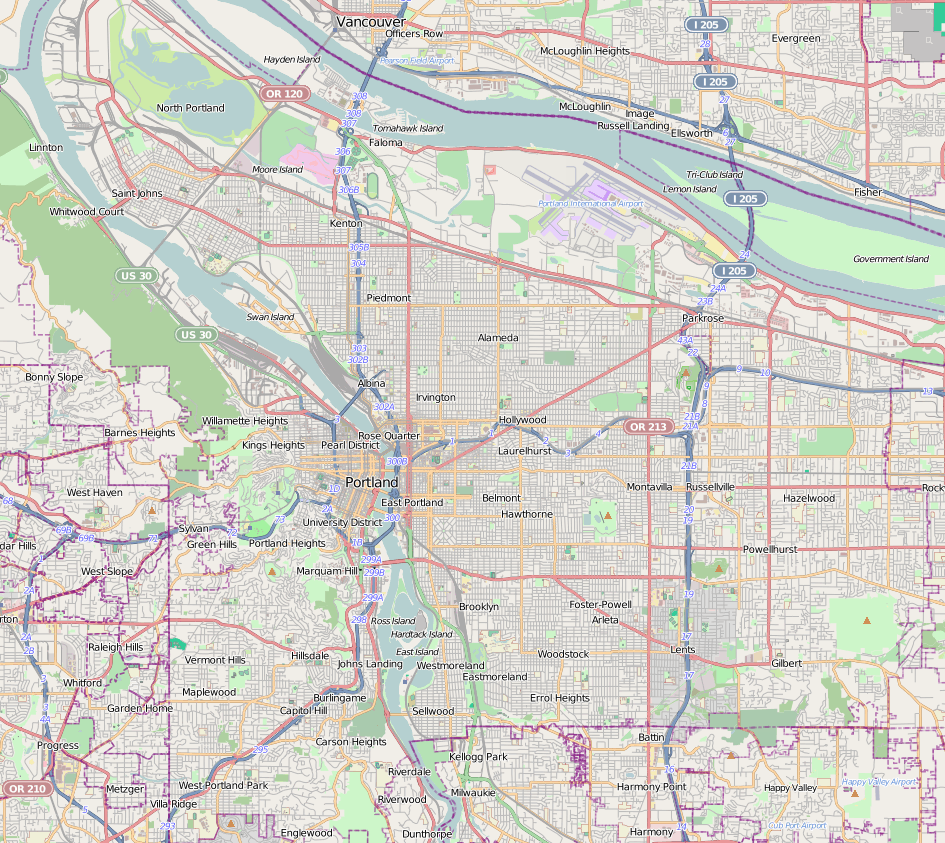
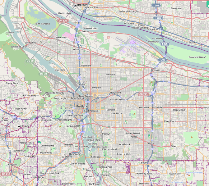
Map of Portland, Oregon This map of Portland was created from OpenStreetMap project data, collected by the community. This map may be incomplete, and may contain errors. Don't rely solely on it for navigation. |
|||||||||
| تاریخ | ||||||||||
| ماخذ | You may find a page on the OpenStreetMap wiki page for Portland | |||||||||
| خالق |
OpenStreetMap contributors OpenStreetMap contributors |
|||||||||
| اجازت (فائل کا دوبارہ استعمال) |
OpenStreetMap data is available under the Open Database License (details). Map tiles are licensed under the Creative Commons Attribution-ShareAlike 2.0 license (CC-BY-SA 2.0).
This file is licensed under the Creative Commons Attribution-Share Alike 2.0 Generic license.
|
|||||||||
| Geotemporal data | ||||||||||
| Bounding box |
|
|||||||||
| Georeferencing | If inappropriate please set warp_status = skip to hide. | |||||||||
فائل کا تاریخچہ
کسی خاص وقت یا تاریخ میں یہ فائل کیسی نظر آتی تھی، اسے دیکھنے کے لیے اس وقت/تاریخ پر کلک کریں۔
| تاریخ/وقت | تھمب نیل | ابعاد | صارف | تبصرہ | |
|---|---|---|---|---|---|
| رائج الوقت | 21:38، 19 دسمبر 2012ء | | 945 × 843 (572 کلوبائٹ) | Calliopejen1 | {{OpenStreetMap | name = Portland | location = Portland | description = Map of Portland, Oregon | top = 45.6358 | bottom = 45.4333 | left = -122.8041 | right = -122.4773 | date = {{dat... |
روابط
درج ذیل صفحہ اس فائل کو استعمال کر رہا ہے:
فائل کا عالمی استعمال
مندرجہ ذیل ویکیوں میں یہ فائل زیر استعمال ہے:
- ar.wikipedia.org پر استعمال
- ceb.wikipedia.org پر استعمال
- en.wikipedia.org پر استعمال
- Moda Center
- Oregon Museum of Science and Industry
- International Rose Test Garden
- Pittock Mansion
- Providence Park
- Interstate Bridge
- Kennedy School
- The Grotto (Portland, Oregon)
- World Forestry Center
- Chiles Center
- Satyricon (nightclub)
- Portland Japanese Garden
- Leach Botanical Garden
- Crystal Springs Rhododendron Garden
- Washington Park (Portland, Oregon)
- Hoyt Arboretum
- Shriners Hospital for Children (Portland)
- Hollywood Theatre (Portland, Oregon)
- Providence Portland Medical Center
- Alberta Arts District
- Parkrose Heights, Portland, Oregon
- Bagdad Theatre
- St. Johns Post Office (Portland, Oregon)
- Peacock Lane
- Wikipedia:WikiProject Oregon/Graphics
- Doernbecher Children's Hospital
- Mount Tabor (Oregon)
- Woodland Park Hospital
- Legacy Emanuel Medical Center
- John Ross Tower
- The Ardea
- Mirabella Portland
- Congregation Beth Israel (Portland, Oregon)
- Zimmerman–Rudeen House
- Legacy Good Samaritan Medical Center
- Oregon Health & Science University Hospital
- John Palmer House (Portland, Oregon)
- OHSU Center for Health & Healing
- Kenton Hotel
- Tannler–Armstrong House
- Johan Poulsen House
- Coleman–Scott House
- Arnold–Park Log Home
- Mount Hood Masonic Temple
- Shriners Hospital for Crippled Children (Portland, Oregon)
- Aubrey R. Watzek House
اس فائل کا مزید عالمی استعمال دیکھیے۔