
فائل:South Sudan adm location map.svg

اصل فائل (ایس وی جی فائل، ابعاد 1,561 × 1,133 پکسل، فائل کا حجم: 201 کلوبائٹ)
خلاصہ
| تفصیل |
Deutsch: Positionskarte von Südsudan
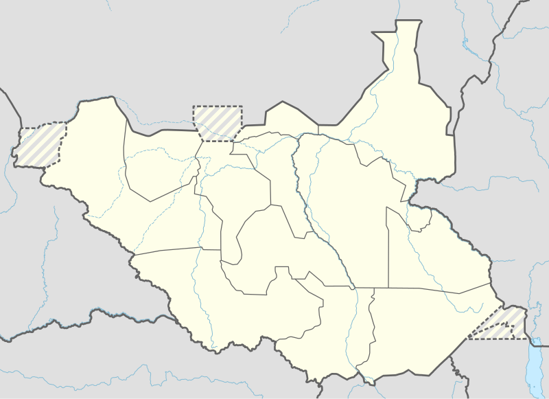
English: Location map of South Sudan
|
||||||||||||
| تاریخ | |||||||||||||
| ماخذ |
Own work using:
|
||||||||||||
| مصنف | NordNordWest | ||||||||||||
| دوسرے نسخے |
|
||||||||||||
_adm_location_map.svg)
_adm_location_map.svg)


|
This map has been made or improved in the German Kartenwerkstatt (Map Lab). You can propose maps to improve as well.
|
اجازہ کاری
Usage of this file with:

explanatory notes: Legally binding is only the full legalcode. For a free usage I recommend to respect the following licence conditions:
1. Provide my name as given above: NordNordWest,
2. a copy of, or the URI for, the applicable license: https://creativecommons.org/licenses/by-sa/3.0/de/legalcode,
3. the title of the work,
4. in the case of an adaptation, a credit identifying the use of the work in the adaptation.
This license and the rights granted hereunder will terminate automatically upon any breach by you of the terms of this license. Any of the above conditions can be waived if you get permission from the copyright holder. If you have questions or wish differing conditions, please contact me through nnwest or my discussion page ![]() t-online.de
t-online.de
- آپ آزاد ہیں:
- شیئر کرنے – کام کو نقل، تقسیم یا منتقل کرنے کے لیے
- ریمکس کے لیے – کام منبطق کرنے کے لیے
- مندرجہ ذیل شرائط کے تحت:
- انتساب – آپ کو اس کام کا انتساب مصنف یا اجازت دہندہ کے بتائے گئے طریقہ کے مطابق دینا ہوگا (تاہم یہ انتساب اس طرح نہیں ہونا چاہیے کہ اسے دیکھ کر ایسا محسوس ہو کہ اصل مصنف یا اجازت دہندہ آپ کے یا آپ کے ذریعہ اس کام کے استعمال کرنے کے حامی ہیں)۔
- یکساں شراکت – اگر آپ اس کام میں کوئی تبدیلی یا ترمیم کرتے ہیں یا اس کام پر مبنی کچھ نیا بناتے ہیں تو اسے بھی آپ اسی یا اس جیسے کسی اجازت نامے کے تحت شائع کر سکتے ہیں۔

فائل کا تاریخچہ
کسی خاص وقت یا تاریخ میں یہ فائل کیسی نظر آتی تھی، اسے دیکھنے کے لیے اس وقت/تاریخ پر کلک کریں۔
| تاریخ/وقت | تھمب نیل | ابعاد | صارف | تبصرہ | |
|---|---|---|---|---|---|
| رائج الوقت | 18:25، 23 اپریل 2020ء | | 1,561 × 1,133 (201 کلوبائٹ) | Leviavery | Added Pibor and Ruweng Administrative Areas |
| 16:16، 25 فروری 2020ء |  | 1,561 × 1,133 (199 کلوبائٹ) | Myrabert01 | Reverted to version as of 13:47, 25 February 2020 (UTC) South Sudan revert back to 10 States. https://www.aljazeera.com/news/2020/02/6-years-war-peace-finally-south-sudan-200223114919537.html | |
| 14:39، 25 فروری 2020ء |  | 1,561 × 1,133 (213 کلوبائٹ) | NordNordWest | Reverted to version as of 14:39, 13 August 2016 (UTC); no reason for this revert | |
| 13:47، 25 فروری 2020ء |  | 1,561 × 1,133 (199 کلوبائٹ) | Myrabert01 | Reverted to version as of 18:18, 12 November 2014 (UTC). South Sudan revert back to 10 States. | |
| 14:39، 13 اگست 2016ء |  | 1,561 × 1,133 (213 کلوبائٹ) | NordNordWest | corr | |
| 12:31، 12 اگست 2016ء |  | 1,561 × 1,133 (214 کلوبائٹ) | NordNordWest | upd, new states | |
| 18:18، 12 نومبر 2014ء |  | 1,561 × 1,133 (199 کلوبائٹ) | NordNordWest | == {{int:filedesc}} == {{Information |Description= {{de|1=Positionskarte von Südsudan}} {{en|1=Location map of South Sudan}} {{Location map series N |stretching=101 |top=12.7 |bottom=3.2 |left=23.15 |right=36.4 }} |Source={{Own using}} * United States... |
روابط
درج ذیل صفحہ اس فائل کو استعمال کر رہا ہے:
فائل کا عالمی استعمال
مندرجہ ذیل ویکیوں میں یہ فائل زیر استعمال ہے:
- ab.wikipedia.org پر استعمال
- af.wikipedia.org پر استعمال
- an.wikipedia.org پر استعمال
- av.wikipedia.org پر استعمال
- azb.wikipedia.org پر استعمال
- az.wikipedia.org پر استعمال
- be.wikipedia.org پر استعمال
- bg.wikipedia.org پر استعمال
- bn.wikipedia.org پر استعمال
- bs.wikipedia.org پر استعمال
- ceb.wikipedia.org پر استعمال
اس فائل کا مزید عالمی استعمال دیکھیے۔