
فائل:USA Mass Cape Cod location map.svg

اس SVG فائل کی PNG نمائش کا حجم: 560 × 420 پکسلز دیگر تصمیمات: 320 × 240 پکسلز | 640 × 480 پکسلز | 1,024 × 768 پکسلز | 1,280 × 960 پکسلز | 2,560 × 1,920 پکسلز۔
اصل فائل (ایس وی جی فائل، ابعاد 560 × 420 پکسل، فائل کا حجم: 264 کلوبائٹ)
خلاصہ
| تفصیل |
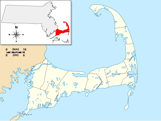
English: Location Map specific to (and zoomed to) Cape Cod, made specifically for the "WikiProject Massachusetts - Cape Cod and the Islands" on the English Wikipedia, but it is available to all.
For detailed instructions and several examples showing the various ways to use this file, see the documentation page at en:Module:Location map/data/USA Cape Cod. Specifications:
|
| تاریخ | |
| ماخذ | ذاتی کام |
| مصنف | Grolltech |
| دوسرے نسخے |
This file was derived from: USA Massachusetts location map.svg: |
| SVG genesis |
اجازہ کاری
میں اس تخلیقی کام کے حقوق کا مالک ہوں اور اسے مندرجہ ذیل اجازت نامے کے تحت شائع کرتا ہوں:
اس ملف کا لائسنس Creative Commons Attribution-Share Alike 3.0 Unported کے تحط ہے۔
- آپ آزاد ہیں:
- شیئر کرنے – کام کو نقل، تقسیم یا منتقل کرنے کے لیے
- ریمکس کے لیے – کام منبطق کرنے کے لیے
- مندرجہ ذیل شرائط کے تحت:
- انتساب – آپ کو اس کام کا انتساب مصنف یا اجازت دہندہ کے بتائے گئے طریقہ کے مطابق دینا ہوگا (تاہم یہ انتساب اس طرح نہیں ہونا چاہیے کہ اسے دیکھ کر ایسا محسوس ہو کہ اصل مصنف یا اجازت دہندہ آپ کے یا آپ کے ذریعہ اس کام کے استعمال کرنے کے حامی ہیں)۔
- یکساں شراکت – اگر آپ اس کام میں کوئی تبدیلی یا ترمیم کرتے ہیں یا اس کام پر مبنی کچھ نیا بناتے ہیں تو اسے بھی آپ اسی یا اس جیسے کسی اجازت نامے کے تحت شائع کر سکتے ہیں۔
فائل کا تاریخچہ
کسی خاص وقت یا تاریخ میں یہ فائل کیسی نظر آتی تھی، اسے دیکھنے کے لیے اس وقت/تاریخ پر کلک کریں۔
| تاریخ/وقت | تھمب نیل | ابعاد | صارف | تبصرہ | |
|---|---|---|---|---|---|
| رائج الوقت | 11:25، 13 مئی 2013ء | | 560 × 420 (264 کلوبائٹ) | Grolltech | reshaped Monomoy; added overlay layers to facilitate reuse of this file |
| 22:45، 7 مئی 2013ء |  | 560 × 420 (189 کلوبائٹ) | Grolltech | further reduced thickness of town boundaries, land outlines | |
| 08:10، 6 مئی 2013ء |  | 560 × 420 (206 کلوبائٹ) | Grolltech | moved compass rose out of the way | |
| 17:39، 31 مئی 2012ء |  | 560 × 420 (205 کلوبائٹ) | Grolltech | 1) moved scale legend to the left edge, and 2) reduced thickness of town boundaries, land outlines, lakes and ponds. Both of these changes are intended lessen the impact on readability of pushpin labels. | |
| 17:21، 13 مئی 2012ء |  | 560 × 420 (206 کلوبائٹ) | Grolltech | added town boundaries | |
| 05:51، 13 مئی 2012ء |  | 560 × 420 (190 کلوبائٹ) | Grolltech | {{Information |Description ={{en|1=Locator Map for Cape Cod exclusively. Made for "Wikiproject Massachusetts - Cape Cod and the Islands". Equirectangular projection, N/S stretching 130.0 %. Geographic limits of the map: Northern boundary: 42.104... |
روابط
درج ذیل صفحہ اس فائل کو استعمال کر رہا ہے:
فائل کا عالمی استعمال
مندرجہ ذیل ویکیوں میں یہ فائل زیر استعمال ہے:
- ar.wikipedia.org پر استعمال
- azb.wikipedia.org پر استعمال
- ceb.wikipedia.org پر استعمال
- en.wikipedia.org پر استعمال
- Cape Cod
- Cape Cod Canal
- Provincetown Harbor
- Cape Cod Baseball League
- Eastham Windmill
- Sagamore Beach, Massachusetts
- Attaquin Beach
- Provincetown Historic District
- Race Point Light
- Center Methodist Church
- Provincetown Public Library (old)
- North Truro Air Force Station
- South Harwich, Massachusetts
- Hyannis Armory
- Louis Brandeis House
- Nauset Archeological District
- Ancient Burying Ground
- Chatham Windmill
- First Universalist Church (Provincetown, Massachusetts)
- Adams-Crocker-Fish House
- South Harwich Methodist Church
- Osterville Baptist Church
- Old Higgins Farm Windmill
- Universalist Society Meetinghouse
- Poor House and Methodist Cemetery
- Cove Burying Ground
- Bridge Road Cemetery
- Old Indian Meeting House
- Ahearn House and Summer House
- Josiah A. Ames House
- Atwood–Higgins Historic District
- Barnstable County Courthouse
- Avant House (Mashpee, Massachusetts)
- Capt. Rodney J. Baxter House
- George I. Briggs House
- Benjamin Baker Jr. House
- Capt. Seth Baker Jr. House
- Nathaniel Baker House
- Baxter Mill
- Lemuel B. Chase House
- Canary-Hartnett House
- Brewster Old King's Highway Historic District
- Thomas Bray Farm
اس فائل کا مزید عالمی استعمال دیکھیے۔