
فائل:Badami-chalukya-empire-map.svg

اصل فائل (ایس وی جی فائل، ابعاد 1,510 × 1,753 پکسل، فائل کا حجم: 339 کلوبائٹ)
خلاصہ
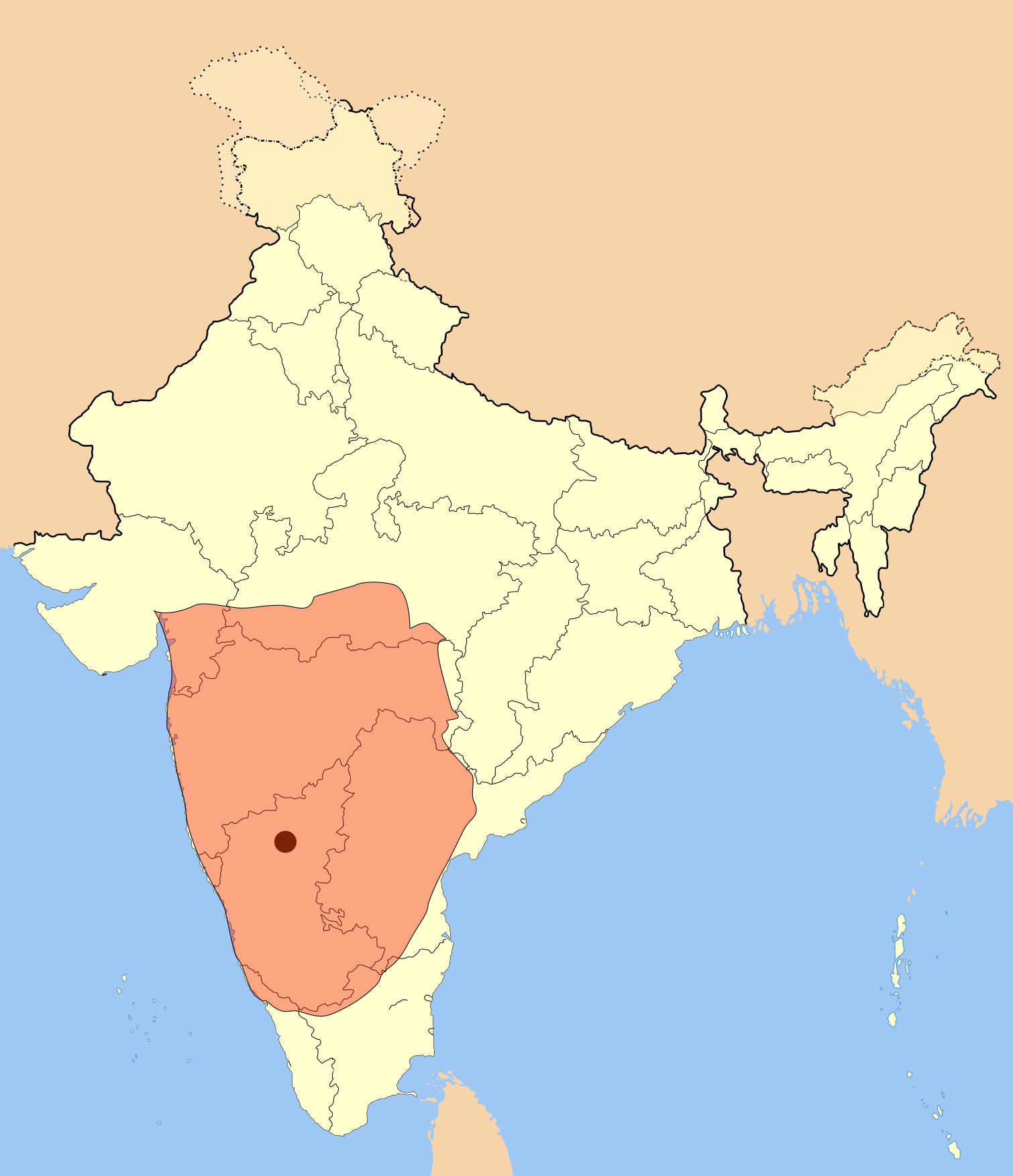
I used Image:India-locator-map-blank.svg as base and edited myself using inkspace and created it by looking at the following source.
Suryanath U. Kamat, A Concise history of Karnataka from pre-historic times to the present, Jupiter books, MCC, Bangalore, 2001 (Reprinted 2002) OCLC: 7796041 p327
A province of this empire comprising of Andhra region became the "Eastern Chalukyas" in the years following the death of Pulakesi II.
Note: Original source has overlay of Kadamba, Rastrakuta and Western Ganga kingdom maps on the same page, I placed only the Badami Chalukya empire map.
| تفصیل | Badami Chalukya Empire Map |
| تاریخ | |
| ماخذ | ذاتی کام |
| مصنف | Mlpkr |
اجازہ کاری

|
آپ کو آزاد سافٹ ویئر فاؤنڈیشن کی جانب سے شائع کردہ جی این یو آزاد مسوداتی اجازت نامہ کی شرائط استعمال کے تحت اس دستاویز کو نقل، تقسیم اور/ یا ترمیم کرنے کی اجازت دی جاتی ہے۔ اس اجازت نامہ کی ایک نقل 'جی این یو آزاد مسوداتی اجازت نامہ کے عنوان سے میسر ہے۔ |
| اس ملف کا لائسنس Creative Commons Attribution-Share Alike 3.0 Unported کے تحط ہے۔ | ||
| ||
| This licensing tag was added to this file as part of the GFDL licensing update. |
- آپ آزاد ہیں:
- شیئر کرنے – کام کو نقل، تقسیم یا منتقل کرنے کے لیے
- ریمکس کے لیے – کام منبطق کرنے کے لیے
- مندرجہ ذیل شرائط کے تحت:
- انتساب – آپ کو اس کام کا انتساب مصنف یا اجازت دہندہ کے بتائے گئے طریقہ کے مطابق دینا ہوگا (تاہم یہ انتساب اس طرح نہیں ہونا چاہیے کہ اسے دیکھ کر ایسا محسوس ہو کہ اصل مصنف یا اجازت دہندہ آپ کے یا آپ کے ذریعہ اس کام کے استعمال کرنے کے حامی ہیں)۔
- یکساں شراکت – اگر آپ اس کام میں کوئی تبدیلی یا ترمیم کرتے ہیں یا اس کام پر مبنی کچھ نیا بناتے ہیں تو اسے بھی آپ اسی یا اس جیسے کسی اجازت نامے کے تحت شائع کر سکتے ہیں۔
فائل کا تاریخچہ
کسی خاص وقت یا تاریخ میں یہ فائل کیسی نظر آتی تھی، اسے دیکھنے کے لیے اس وقت/تاریخ پر کلک کریں۔
| تاریخ/وقت | تھمب نیل | ابعاد | صارف | تبصرہ | |
|---|---|---|---|---|---|
| رائج الوقت | 00:28، 19 جولائی 2017ء | | 1,510 × 1,753 (339 کلوبائٹ) | Renato de Carvalho Ferreira | Ajustes gerais |
| 22:49، 27 مئی 2007ء |  | 1,651 × 1,753 (432 کلوبائٹ) | Mlpkr | I used Image:India-locator-map-blank.svg as base and edited myself using inkspace and created it by looking at the following source. Suryanath U. Kamat, A Concise history of Karnataka from pre-historic times to the present, Jupiter books, MCC, Bangalore | |
| 23:09، 26 مئی 2007ء |  | 1,651 × 1,753 (432 کلوبائٹ) | Mlpkr | == Summary == I used Image:India-locator-map-blank.svg as base and edited myself using inkspace and created it by looking at the following source. Suryanath U. Kamat, A Concise history of Karnataka from pre-historic times to the present, Jupiter books, | |
| 22:25، 26 مئی 2007ء |  | 1,651 × 1,753 (431 کلوبائٹ) | Mlpkr | {{Information |Description= |Source=self-made |Date= |Author= User:Mlpkr }} |
روابط
درج ذیل 3 صفحات اس فائل کو استعمال کر رہے ہیں:
فائل کا عالمی استعمال
مندرجہ ذیل ویکیوں میں یہ فائل زیر استعمال ہے:
- ar.wikipedia.org پر استعمال
- ba.wikipedia.org پر استعمال
- bn.wikipedia.org پر استعمال
- ca.wikipedia.org پر استعمال
- da.wikipedia.org پر استعمال
- en.wikipedia.org پر استعمال
- es.wikipedia.org پر استعمال
- fi.wikipedia.org پر استعمال
- fr.wikipedia.org پر استعمال
- gu.wikipedia.org پر استعمال
- hi.wikipedia.org پر استعمال
- hu.wikipedia.org پر استعمال
- hy.wikipedia.org پر استعمال
- id.wikipedia.org پر استعمال
- it.wikipedia.org پر استعمال
- ja.wikipedia.org پر استعمال
- ka.wikipedia.org پر استعمال
- kn.wikipedia.org پر استعمال
- ko.wikipedia.org پر استعمال
- lt.wikipedia.org پر استعمال
- ml.wikipedia.org پر استعمال
- mr.wikipedia.org پر استعمال
- ms.wikipedia.org پر استعمال
- ne.wikipedia.org پر استعمال
اس فائل کا مزید عالمی استعمال دیکھیے۔