فائل:Nicosia boundary extensions.png
Nicosia_boundary_extensions.png (800 × 377 پکسل، فائل کا حجم: 162 کلوبائٹ، MIME قسم: image/png)
خلاصہ[ترمیم]
| تفصیل |
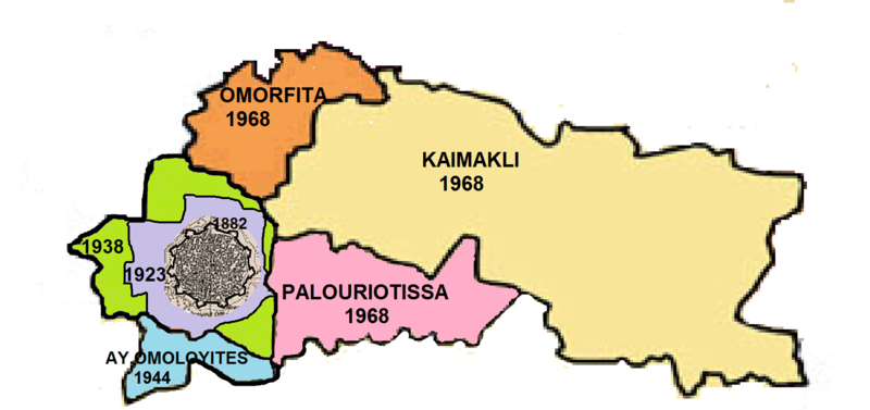
Map showing the area of Nicosia municipality with extensions from 1882-1968 |
|---|---|
| ماخذ |
This is a composite of small extracts from boundary maps already on Wikipedia overlain with boundary extension information taken from the Nicosia municipality web site (Aug 2013), Cyprus Gazette 1923 and "Nicosia" by K. Keshishian |
| تاریخ |
Sep 2013 |
| تصویر ساز | |
| اجازت نامہ (Reusing this file) |
نیچے دیکھیے۔
|
اجازہ کاری[ترمیم]
| یہ تصویر تخلیقی العام انتساب-مماثل شراکت 2.5 اجازہ کے تحت دستیاب ہے۔ |
فائل کا تاریخچہ
کسی خاص وقت یا تاریخ میں یہ فائل کیسی نظر آتی تھی، اسے دیکھنے کے لیے اس وقت/تاریخ پر کلک کریں۔
| تاریخ/وقت | تھمب نیل | ابعاد | صارف | تبصرہ | |
|---|---|---|---|---|---|
| رائج الوقت | 05:51، 29 نومبر 2018ء |  | 800 × 377 (162 کلوبائٹ) | Tahir mq (تبادلۂ خیال | شراکتیں) | {{Information |Description = Map showing the area of Nicosia municipality with extensions from 1882-1968 |Source = This is a composite of small extracts from boundary maps already on Wikipedia overlain with boundary extension information taken from the Nicosia municipality web site (Aug 2013), Cyprus Gazette 1923 and "Nicosia" by K. Keshishian<br/> '''Previously published:''' Published here for the first time to accompany artiocle on Nicosia |Date = Sep 2013 |Author = Tom1955 }} |
آپ اس فائل کو برتحریر نہیں کر سکتے۔
روابط
درج ذیل صفحہ اس فائل کو استعمال کر رہا ہے:

