
فائل:World 1910.jpg

اس نمائش کا حجم: 794 × 600 پکسلز۔ دیگر تصمیمات: 318 × 240 پکسلز | 635 × 480 پکسلز | 1,017 × 768 پکسلز | 1,280 × 967 پکسلز | 2,124 × 1,605 پکسلز۔
اصل فائل (2,124 × 1,605 پکسل، فائل کا حجم: 1.02 MB، MIME قسم: image/jpeg)
خلاصہ
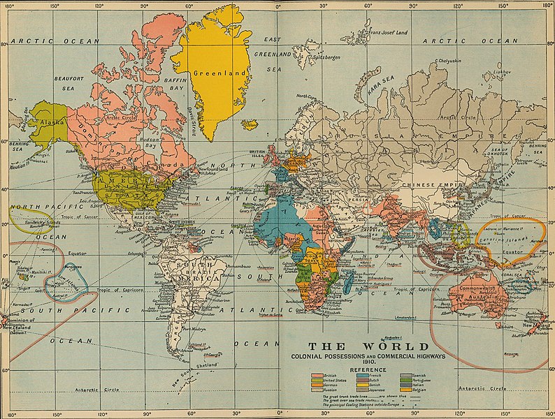
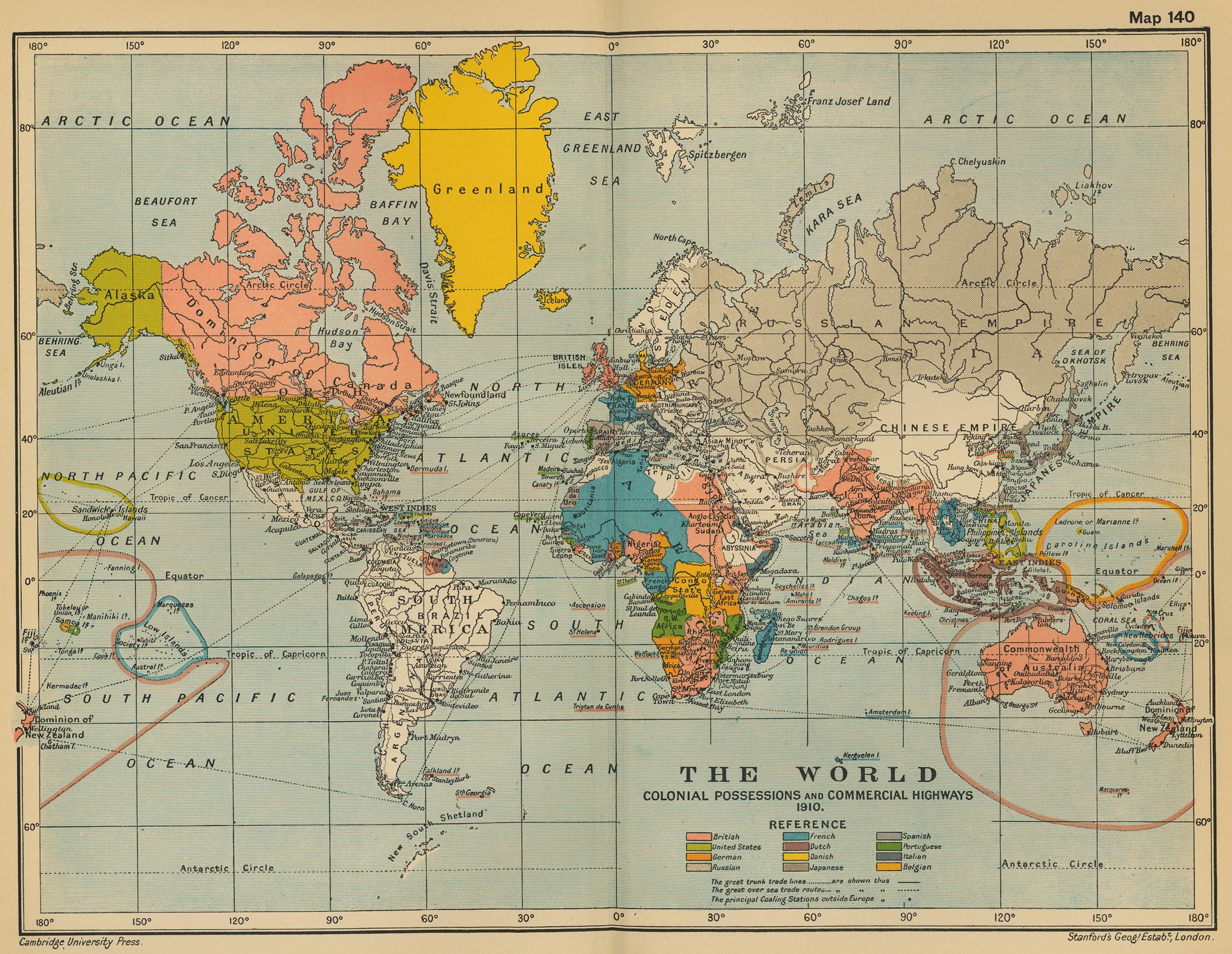
| تفصیل | The World: Colonial Possesions and Commercial Highways, 1910 |
| تاریخ | |
| ماخذ |
University of Texas Libraries, Perry-Castañeda Library Map Collection: Historical Maps, Cambridge Modern History Atlas, 1912 |
| مصنف | Edited by Sir Adolphus William Ward, G.W. Prothero, Sir Stanley Mordaunt Leathes, and E.A. Benians. |
اجازہ کاری
This work is in the public domain in the United States because it was published (or registered with the U.S. Copyright Office) before January 1, 1929.
Public domain works must be out of copyright in both the United States and in the source country of the work in order to be hosted on the Commons. If the work is not a U.S. work, the file must have an additional copyright tag indicating the copyright status in the source country.
Note: This tag should not be used for sound recordings. |
فائل کا تاریخچہ
کسی خاص وقت یا تاریخ میں یہ فائل کیسی نظر آتی تھی، اسے دیکھنے کے لیے اس وقت/تاریخ پر کلک کریں۔
| تاریخ/وقت | تھمب نیل | ابعاد | صارف | تبصرہ | |
|---|---|---|---|---|---|
| رائج الوقت | 16:16، 9 جولائی 2011ء | | 2,124 × 1,605 (1.02 MB) | Citypeek | turn and removal border |
| 02:31، 20 جولائی 2006ء |  | 2,201 × 1,705 (971 کلوبائٹ) | Roke~commonswiki | from [http://www.lib.utexas.edu/maps/historical/ward_1912/world_1910.jpg] Perry-Castañeda Library Map Collection Cambridge Modern History Atlas, 1912 Category: Old maps |
روابط
درج ذیل 3 صفحات اس فائل کو استعمال کر رہے ہیں:
فائل کا عالمی استعمال
مندرجہ ذیل ویکیوں میں یہ فائل زیر استعمال ہے:
- ar.wikipedia.org پر استعمال
- as.wikipedia.org پر استعمال
- de.wikipedia.org پر استعمال
- en.wikipedia.org پر استعمال
- fa.wikipedia.org پر استعمال
- fr.wikipedia.org پر استعمال
- he.wikiquote.org پر استعمال
- hi.wikipedia.org پر استعمال
- hr.wikipedia.org پر استعمال
- it.wikipedia.org پر استعمال
- pl.wikipedia.org پر استعمال
- pnb.wikipedia.org پر استعمال
- ta.wikipedia.org پر استعمال
- th.wikipedia.org پر استعمال
- uk.wikipedia.org پر استعمال
- vi.wikipedia.org پر استعمال
- zh.wikipedia.org پر استعمال