
فائل:Asylum Township.jpg
اس نمائش کا حجم: 800 × 494 پکسلز۔ دیگر تصمیمات: 320 × 197 پکسلز | 640 × 395 پکسلز | 1,024 × 632 پکسلز | 1,280 × 790 پکسلز | 2,560 × 1,579 پکسلز | 3,717 × 2,293 پکسلز۔
اصل فائل (3,717 × 2,293 پکسل، فائل کا حجم: 6.88 MB، MIME قسم: image/jpeg)
| تفصیل |
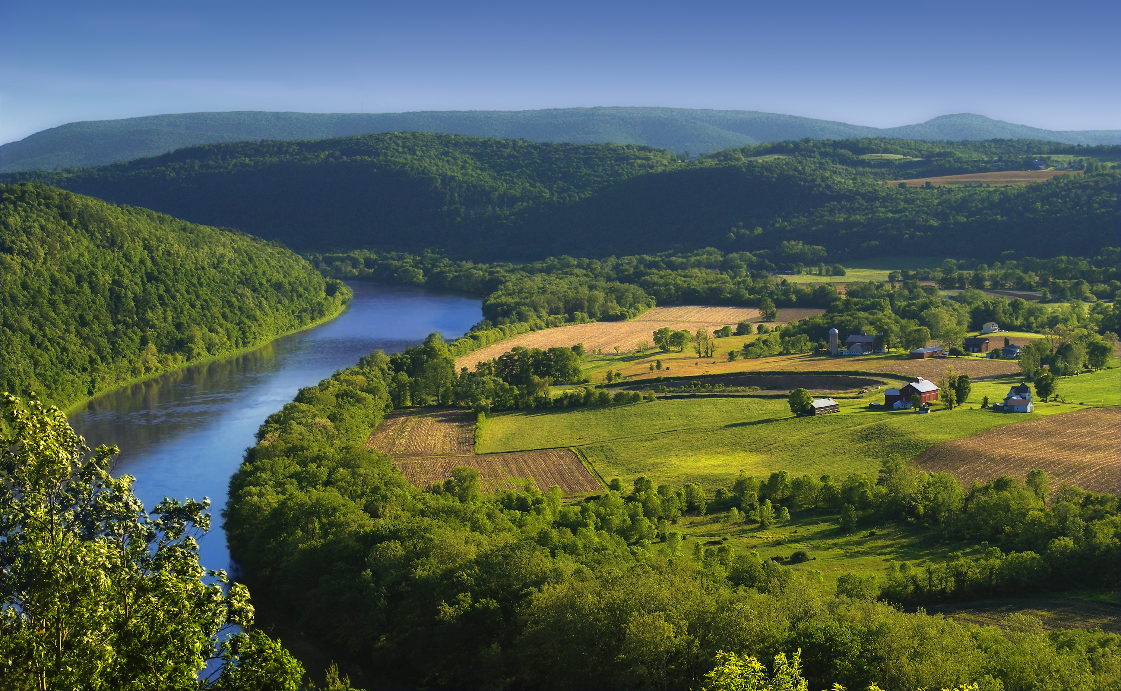
English: The Susquehanna River, Asylum Township, Bradford County, as seen from the Marie Antoinette Lookout off of US Route 6 near Wyalusing in Pennsylvania. Visible from here is the French Azilum Historic Site, where some Revolution-fleeing French aristocrats settled in 1793. It was said that Marie Antoinette planned to settle in a house across the river from the lookout which was allegedly built for her. The marker reads: A settlement of French royalists, who fled the French Revolution in 1793, was established in the valley directly opposite this marker. It was laid out and settled under the direction of Viscount de Noailles and Marquis Antoine Omer Talon. It was hoped that Queen Marie Antoinette might here find safety. Marie Antoinette Lookout, Route 6, Wyalusing, PA. |
||
| تاریخ | |||
| ماخذ | https://www.flickr.com/photos/nicholas_t/3594274494/ | ||
| مصنف | Nicholas A. Tonelli from Northeast Pennsylvania, USA | ||
| اجازت (فائل کا دوبارہ استعمال) |
|
| Camera location | | View this and other nearby images on: OpenStreetMap |
|---|
اجازہ کاری
This file is licensed under the Creative Commons Attribution 2.0 Generic license.
- آپ آزاد ہیں:
- شیئر کرنے – کام کو نقل، تقسیم یا منتقل کرنے کے لیے
- ریمکس کے لیے – کام منبطق کرنے کے لیے
- مندرجہ ذیل شرائط کے تحت:
- انتساب – آپ کو اس کام کا انتساب مصنف یا اجازت دہندہ کے بتائے گئے طریقہ کے مطابق دینا ہوگا (تاہم یہ انتساب اس طرح نہیں ہونا چاہیے کہ اسے دیکھ کر ایسا محسوس ہو کہ اصل مصنف یا اجازت دہندہ آپ کے یا آپ کے ذریعہ اس کام کے استعمال کرنے کے حامی ہیں)۔
فائل کا تاریخچہ
کسی خاص وقت یا تاریخ میں یہ فائل کیسی نظر آتی تھی، اسے دیکھنے کے لیے اس وقت/تاریخ پر کلک کریں۔
| تاریخ/وقت | تھمب نیل | ابعاد | صارف | تبصرہ | |
|---|---|---|---|---|---|
| رائج الوقت | 00:49، 6 جون 2009ء | | 3,717 × 2,293 (6.88 MB) | Flickr upload bot | Uploaded from http://flickr.com/photo/14922165@N00/3594274494 using Flickr upload bot |
روابط
اس فائل سے مربوط کوئی صفحہ موجود نہیں ہے۔
فائل کا عالمی استعمال
مندرجہ ذیل ویکیوں میں یہ فائل زیر استعمال ہے:
- ar.wikipedia.org پر استعمال
- azb.wikipedia.org پر استعمال
- cy.wikipedia.org پر استعمال
- da.wikipedia.org پر استعمال
- en.wikipedia.org پر استعمال
- eo.wikipedia.org پر استعمال
- es.wikipedia.org پر استعمال
- fi.wikipedia.org پر استعمال
- fr.wikipedia.org پر استعمال
- fy.wikipedia.org پر استعمال
- hu.wikipedia.org پر استعمال
- id.wikipedia.org پر استعمال
- it.wikipedia.org پر استعمال
- ko.wikipedia.org پر استعمال
- ml.wikipedia.org پر استعمال
- ms.wikipedia.org پر استعمال
- new.wikipedia.org پر استعمال
- sl.wikipedia.org پر استعمال
- sr.wikipedia.org پر استعمال
- sv.wikipedia.org پر استعمال
- th.wikipedia.org پر استعمال
- tl.wikipedia.org پر استعمال
- tr.wikipedia.org پر استعمال
- uk.wikipedia.org پر استعمال
- vi.wikipedia.org پر استعمال
- www.wikidata.org پر استعمال
- xmf.wikipedia.org پر استعمال
- zh.wikipedia.org پر استعمال
اس فائل کا مزید عالمی استعمال دیکھیے۔