
فائل:Diehls Covered Bridge.jpg
اس نمائش کا حجم: 800 × 549 پکسلز۔ دیگر تصمیمات: 320 × 220 پکسلز | 640 × 439 پکسلز | 1,024 × 703 پکسلز | 1,280 × 879 پکسلز | 2,560 × 1,758 پکسلز | 4,772 × 3,277 پکسلز۔
اصل فائل (4,772 × 3,277 پکسل، فائل کا حجم: 1.67 MB، MIME قسم: image/jpeg)
|
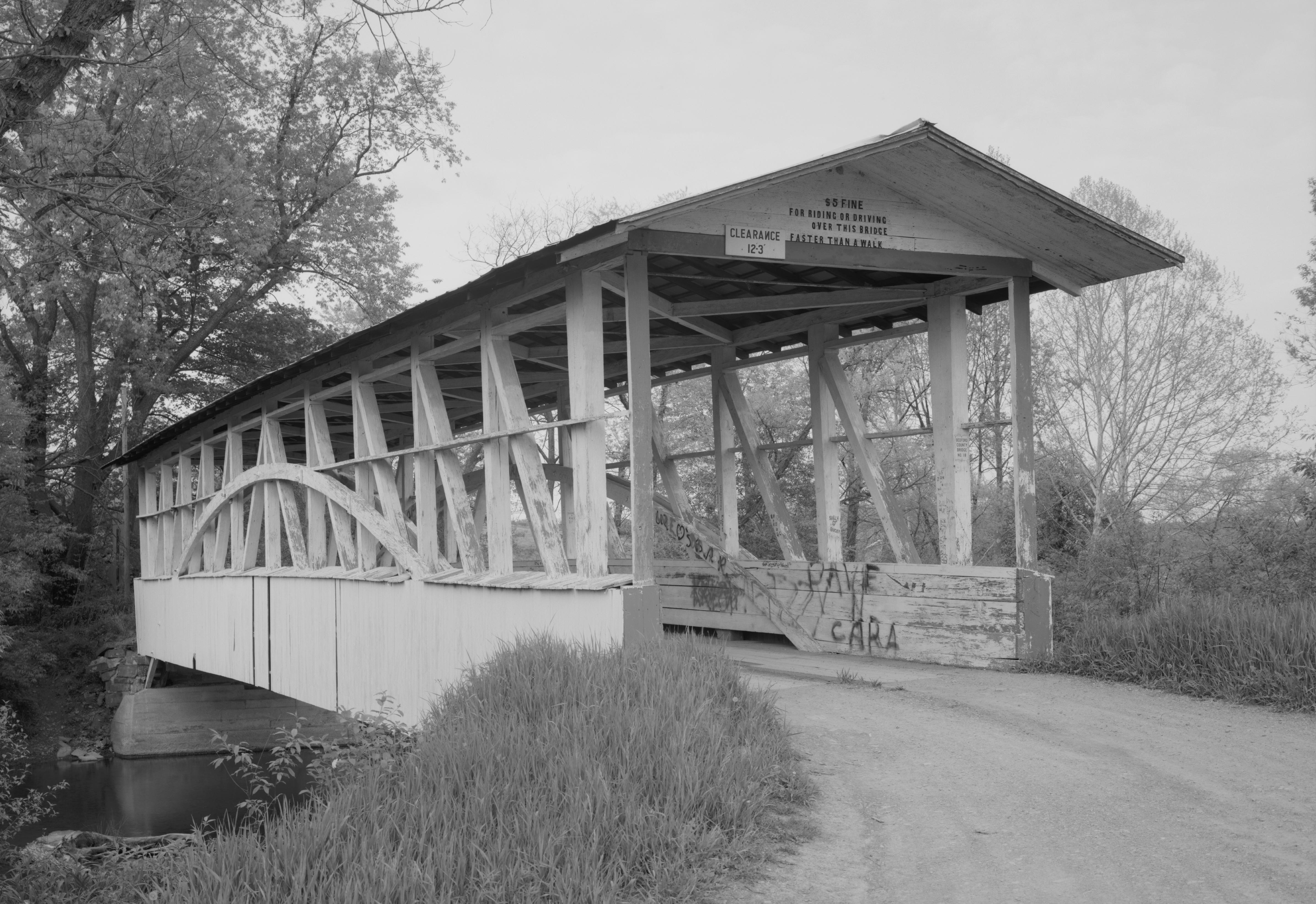
This is an image of a place or building that is listed on the National Register of Historic Places in the United States of America. Its reference number is 80003420. |
| Camera location | | View this and other nearby images on: OpenStreetMap |
|---|
| تفصیل |
English: Southern end of the Diehls Covered Bridge, which carries Township Route 418 over the Raystown Branch of the Juniata River south of Schellsburg in Harrison and Napier Townships of Bedford County, Pennsylvania, United States. Built in 1892, this Burr arch truss bridge is listed on the National Register of Historic Places. |
|||||||||||||||||||||||
| تاریخ | ||||||||||||||||||||||||
| ماخذ | Library of Congress, Prints and Photograph Division HAER: PA,5-MANCH.V,1-1 | |||||||||||||||||||||||
| مصنف |
|
|||||||||||||||||||||||
| اجازت (فائل کا دوبارہ استعمال) |
|
|||||||||||||||||||||||
.jpg)

|
This image is available from the United States Library of Congress's Prints and Photographs division
under the digital ID hhh.pa3207. This tag does not indicate the copyright status of the attached work. A normal copyright tag is still required. See Commons:Licensing.
|
فائل کا تاریخچہ
کسی خاص وقت یا تاریخ میں یہ فائل کیسی نظر آتی تھی، اسے دیکھنے کے لیے اس وقت/تاریخ پر کلک کریں۔
| تاریخ/وقت | تھمب نیل | ابعاد | صارف | تبصرہ | |
|---|---|---|---|---|---|
| رائج الوقت | 13:51، 21 دسمبر 2009ء | | 4,772 × 3,277 (1.67 MB) | Nyttend | {{Location|40|0|34|N|78|38|55|W}} {{Information |Description={{en|Southern end of the {{w|Diehls Covered Bridge}}, which carries Township Route 418 over the {{w|Raystown Branch Juniata River|Raystown Branch}} of the {{w|Juniata River}} south of {{w|Schell |
روابط
درج ذیل صفحہ اس فائل کو استعمال کر رہا ہے:
فائل کا عالمی استعمال
مندرجہ ذیل ویکیوں میں یہ فائل زیر استعمال ہے:
- ca.wikipedia.org پر استعمال
- en.wikipedia.org پر استعمال
- es.wikipedia.org پر استعمال
- fr.wikipedia.org پر استعمال
- ha.wikipedia.org پر استعمال
- it.wikipedia.org پر استعمال
- tl.wikipedia.org پر استعمال
- uk.wikipedia.org پر استعمال
- vi.wikipedia.org پر استعمال
- www.wikidata.org پر استعمال