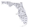
فائل:Florida counties.jpg

اس نمائش کا حجم: 617 × 600 پکسلز۔ دیگر تصمیمات: 247 × 240 پکسلز | 494 × 480 پکسلز | 865 × 841 پکسلز۔
اصل فائل (865 × 841 پکسل، فائل کا حجم: 223 کلوبائٹ، MIME قسم: image/jpeg)
فائل کا تاریخچہ
کسی خاص وقت یا تاریخ میں یہ فائل کیسی نظر آتی تھی، اسے دیکھنے کے لیے اس وقت/تاریخ پر کلک کریں۔
| تاریخ/وقت | تھمب نیل | ابعاد | صارف | تبصرہ | |
|---|---|---|---|---|---|
| رائج الوقت | 22:26، 3 فروری 2010ء |  | 865 × 841 (223 کلوبائٹ) | Jujutacular | {{Information |Description={{en|1=A map of Florida's counties}} |Source=[http://quickfacts.census.gov/qfd/maps/florida_map.html] - US Census Bureau |Author=US Census Bureau |Date=??? |Permission=See below. |other_versions=[[:File:Florida counties map.png] |
روابط
درج ذیل صفحہ اس فائل کو استعمال کر رہا ہے:
فائل کا عالمی استعمال
مندرجہ ذیل ویکیوں میں یہ فائل زیر استعمال ہے:
- arz.wikipedia.org پر استعمال
- en.wikipedia.org پر استعمال
- he.wikipedia.org پر استعمال
- hu.wikipedia.org پر استعمال
- hu.wiktionary.org پر استعمال
- ja.wikipedia.org پر استعمال
- zh.wikipedia.org پر استعمال

