
فائل:Isles of Scilly UK location map.svg

اس SVG فائل کی PNG نمائش کا حجم: 677 × 600 پکسلز دیگر تصمیمات: 271 × 240 پکسلز | 542 × 480 پکسلز | 867 × 768 پکسلز | 1,156 × 1,024 پکسلز | 2,312 × 2,048 پکسلز | 1,340 × 1,187 پکسلز۔
اصل فائل (ایس وی جی فائل، ابعاد 1,340 × 1,187 پکسل، فائل کا حجم: 558 کلوبائٹ)
| تفصیل |
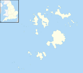
Blank map of the Isles of Scilly, UK with districts shown. Equirectangular map projection on WGS 84 datum, with N/S stretched 150% Geographic limits:
|
| تاریخ | |
| ماخذ | Ordnance Survey OpenData. Most data from Boundary-Line product. Lake data from Meridian 2 product. Inset derived from England location map.svg by Spischot. |
| مصنف | Nilfanion, created using Ordnance Survey data |
| اجازت (فائل کا دوبارہ استعمال) |
اس ملف کا لائسنس Creative Commons Attribution-Share Alike 3.0 Unported کے تحط ہے۔ لگاؤ: Contains Ordnance Survey data © Crown copyright and database right
|
فائل کا تاریخچہ
کسی خاص وقت یا تاریخ میں یہ فائل کیسی نظر آتی تھی، اسے دیکھنے کے لیے اس وقت/تاریخ پر کلک کریں۔
| تاریخ/وقت | تھمب نیل | ابعاد | صارف | تبصرہ | |
|---|---|---|---|---|---|
| رائج الوقت | 20:39، 26 ستمبر 2010ء | | 1,340 × 1,187 (558 کلوبائٹ) | Nilfanion | {{Information |Description=Blank map of the Isles of Scilly, UK with districts shown. Equirectangular map projection on WGS 84 datum, with N/S stretched 150% Geographic limits: *West: 6.45W *East: 6.23W *North: 49.99N *South: 49.86 |
روابط
درج ذیل صفحہ اس فائل کو استعمال کر رہا ہے:
فائل کا عالمی استعمال
مندرجہ ذیل ویکیوں میں یہ فائل زیر استعمال ہے:
- af.wikipedia.org پر استعمال
- ar.wikipedia.org پر استعمال
- arz.wikipedia.org پر استعمال
- ast.wikipedia.org پر استعمال
- ca.wikipedia.org پر استعمال
- ceb.wikipedia.org پر استعمال
- de.wikipedia.org پر استعمال
- Bishop Rock
- Samson (Insel)
- Annet (Scilly-Inseln)
- St Mary’s (Scilly-Inseln)
- St Mary’s Airport
- Tresco
- Hugh Town
- St. Martin’s
- Great Ganilly
- Teän
- St. Helen’s
- Zantman’s Rock
- Crim Rocks
- Round Island (Scilly-Inseln)
- Rosevear
- Bryher
- Gweal
- Gugh
- Vorlage:Positionskarte England Scilly-Inseln
- St. Agnes (Scilly-Inseln)
- White Island (Scilly-Inseln)
- Norrard Rocks
- Western Rocks (Scilly-Inseln)
- Eastern Isles
- Tresco Heliport
- el.wikipedia.org پر استعمال
- en.wikipedia.org پر استعمال
- Samson, Isles of Scilly
- Tresco, Isles of Scilly
- St Mary's, Isles of Scilly
- Hugh Town
- HMS Colossus (1787)
- Bant's Carn
- Porth Hellick Down
- Pednathise Head
- St Agnes, Isles of Scilly
- Bryher
- St Martin's, Isles of Scilly
- Zantman's Rock
- MV Cita
- Minnehaha (cargo ship)
- SS Thames
- Annet, Isles of Scilly
- Crim Rocks
اس فائل کا مزید عالمی استعمال دیکھیے۔