
فائل:LocationIndia.png

اس نمائش کا حجم: 800 × 370 پکسلز۔ دیگر تصمیمات: 320 × 148 پکسلز | 640 × 296 پکسلز | 1,357 × 628 پکسلز۔
اصل فائل (1,357 × 628 پکسل، فائل کا حجم: 21 کلوبائٹ، MIME قسم: image/png)

|
This locator map image could be re-created using vector graphics as an SVG file. This has several advantages; see Commons:Media for cleanup for more information. If an SVG form of this image is available, please upload it and afterwards replace this template with
{{vector version available|new image name}}.
It is recommended to name the SVG file “LocationIndia.svg”—then the template Vector version available (or Vva) does not need the new image name parameter. |
خلاصہ
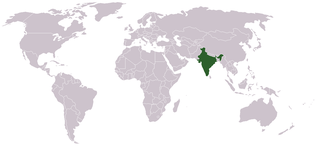
Location map for w:India.
User:dbenbenn modified Image:BlankMap-World.png.
اجازہ کاری
| |
تخلیق کار Vardion, at the انگریزی ویکیپیڈیا project نے اس کام کو دائرہ عام میں شائع کیا ہے جس کا اطلاق عالمی سطح پر ہوتا ہے۔ In case this is not legally possible: |
فائل کا تاریخچہ
کسی خاص وقت یا تاریخ میں یہ فائل کیسی نظر آتی تھی، اسے دیکھنے کے لیے اس وقت/تاریخ پر کلک کریں۔
| تاریخ/وقت | تھمب نیل | ابعاد | صارف | تبصرہ | |
|---|---|---|---|---|---|
| رائج الوقت | 07:35، 11 ستمبر 2021ء | | 1,357 × 628 (21 کلوبائٹ) | Ytpks896 | Reverted to version as of 22:39, 12 February 2005 (UTC) |
| 13:37، 29 جولائی 2021ء |  | 1,427 × 628 (103 کلوبائٹ) | Ytpks896 | Reverted to version as of 03:16, 1 May 2008 (UTC) | |
| 00:33، 15 فروری 2010ء |  | 1,357 × 628 (24 کلوبائٹ) | King Zebu | Reverted to version as of 09:17, 3 June 2005 Please discuss before making such edits in future. | |
| 03:16، 1 مئی 2008ء |  | 1,427 × 628 (103 کلوبائٹ) | KAVO | (Changed to colours more noticeable: *Light green - Claimed by India, not administered by India **(Aksai Chin, Azad Kashmir, Northern Areas, Shaksgam Valley) *Deep Green - Disputed with other nations, administered by India **(Arunachal Pradesh, Jammu and | |
| 09:17، 3 جون 2005ء |  | 1,357 × 628 (24 کلوبائٹ) | Nichalp | NPOV map, please discuss any changes with me for NPOV status | |
| 22:39، 12 فروری 2005ء |  | 1,357 × 628 (21 کلوبائٹ) | Dbenbenn | higher resolution version, without black border | |
| 20:28، 5 دسمبر 2004ء |  | 250 × 115 (18 کلوبائٹ) | EugeneZelenko | Location map for India.<br/>Originally created for English Wikipedia by Vardion.<br/>{{GFDL}} |
روابط
اس فائل سے مربوط کوئی صفحہ موجود نہیں ہے۔
فائل کا عالمی استعمال
مندرجہ ذیل ویکیوں میں یہ فائل زیر استعمال ہے:
- ar.wikinews.org پر استعمال
- ckb.wikipedia.org پر استعمال
- en.wikipedia.org پر استعمال
- en.wikinews.org پر استعمال
- en.wikivoyage.org پر استعمال
- en.wiktionary.org پر استعمال
- fr.wikinews.org پر استعمال
- fur.wikipedia.org پر استعمال
- he.wikivoyage.org پر استعمال
- hr.wikipedia.org پر استعمال
- hr.wikiquote.org پر استعمال
- incubator.wikimedia.org پر استعمال
- ko.wikipedia.org پر استعمال
- li.wikinews.org پر استعمال
- pam.wikipedia.org پر استعمال
- pl.wiktionary.org پر استعمال
- ps.wikivoyage.org پر استعمال
- pt.wikivoyage.org پر استعمال
- pt.wiktionary.org پر استعمال
- sr.wikibooks.org پر استعمال
- sv.wikinews.org پر استعمال
اس فائل کا مزید عالمی استعمال دیکھیے۔