
فائل:Location San Marino Europe.svg

اس SVG فائل کی PNG نمائش کا حجم: 713 × 600 پکسلز دیگر تصمیمات: 285 × 240 پکسلز | 571 × 480 پکسلز | 913 × 768 پکسلز | 1,218 × 1,024 پکسلز | 2,435 × 2,048 پکسلز | 2,045 × 1,720 پکسلز۔
اصل فائل (ایس وی جی فائل، ابعاد 2,045 × 1,720 پکسل، فائل کا حجم: 4.51 MB)
خلاصہ
| تفصیل |
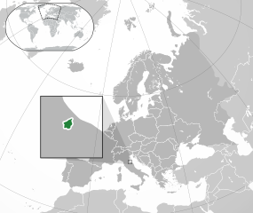
English: Location of San Marino in Europe.
Italiano: Posizione di San Marino in Europa. |
| تاریخ | (UTC) |
| ماخذ |
This file was derived from: |
| مصنف |
اجازہ کاری
اس ملف کا لائسنس Creative Commons Attribution-Share Alike 3.0 Unported کے تحط ہے۔
- آپ آزاد ہیں:
- شیئر کرنے – کام کو نقل، تقسیم یا منتقل کرنے کے لیے
- ریمکس کے لیے – کام منبطق کرنے کے لیے
- مندرجہ ذیل شرائط کے تحت:
- انتساب – آپ کو اس کام کا انتساب مصنف یا اجازت دہندہ کے بتائے گئے طریقہ کے مطابق دینا ہوگا (تاہم یہ انتساب اس طرح نہیں ہونا چاہیے کہ اسے دیکھ کر ایسا محسوس ہو کہ اصل مصنف یا اجازت دہندہ آپ کے یا آپ کے ذریعہ اس کام کے استعمال کرنے کے حامی ہیں)۔
- یکساں شراکت – اگر آپ اس کام میں کوئی تبدیلی یا ترمیم کرتے ہیں یا اس کام پر مبنی کچھ نیا بناتے ہیں تو اسے بھی آپ اسی یا اس جیسے کسی اجازت نامے کے تحت شائع کر سکتے ہیں۔
اولین اپلوڈ کا نوشتہ
This image is a derivative work of the following images:
- File:Location San Marino Europe.png licensed with Cc-by-sa-3.0, GFDL
- 2013-07-02T00:40:32Z Klodde 2056x1800 (455515 Bytes) Bigger
- 2009-06-30T03:08:02Z Bosonic dressing 2056x1800 (378475 Bytes) {{Information |Description={{en|1=San Marino (dark green) / Europe (dark grey); inspired by and consistent with general country locator maps by User:Vardion, et al}} |Source=Own work by uploader |Author=[[User:Bosonic dressin
- File:Europe-Faroe Islands.svg licensed with Cc-by-sa-3.0
- 2020-02-06T08:22:11Z Rob984 2045x1720 (7791783 Bytes) General improvements. Base: [[:File:Location European nation states.svg]]. Zoom insert derived from [[:File:Map of the Faroe Islands de.svg]].
- 2011-02-22T11:24:44Z Chipmunkdavis 2045x1720 (2329810 Bytes) {{Information |Description={{en|1={{Europe-SVG-en|Northern Cyprus}}}} {{en|1=The Full Map of Jersey}} |Source=*[[:File:Europe-Jersey.svg|]] |Date=2011-02-22 11:23 (UTC) |Author=*[[:File:Europe-Jersey.svg|]]: *[[:File:Europe-N
- File:Location European nation states.svg licensed with Cc-by-sa-3.0-migrated, GFDL
- 2020-05-22T17:41:59Z Thayts 2045x1720 (2972998 Bytes) The island of Borkum belongs to Germany, not the Netherlands
- 2020-02-06T03:54:48Z Rob984 2045x1720 (2936560 Bytes) Huge code cleanup + fixed XML errors
- 2020-02-02T06:21:11Z Rob984 2045x1720 (5974727 Bytes) Per COM:OVERWRITE, since this file conforms with UN: Added Morocco-Western Sahara border. Removed border showing Israeli-occupied Golan Heights.
- 2020-02-01T02:16:25Z Rob984 2045x1720 (5937232 Bytes) Fixed Flevoland in the Netherlands, and other minor inaccuracies.
- 2019-12-29T02:09:08Z Rob984 2045x1720 (5955906 Bytes) Minor corrections to shading of islands.
- 2019-12-29T00:50:58Z Rob984 2045x1720 (5955939 Bytes) Per original file: a few disputed areas I changed by accident.
- 2019-12-29T00:10:39Z Rob984 2045x1720 (5858427 Bytes) Subtly revised the pan/scale in order to show the Flores Island in the Azores, and Franz Josef Land (the Russia archipelago north east of Svalbard). Note: the image dimensions remain the same.
- 2017-11-19T14:03:18Z Giorgi Balakhadze 2045x1720 (7667567 Bytes) Rv of Rob984 edits per COM:OVERWRITE, the original file by Ssolbergj had no conflict regions
- 2017-08-29T17:14:14Z Бровар 2045x1720 (7708628 Bytes) Reverted to version as of 01:26, 10 March 2017 (UTC)
- 2017-08-29T17:09:09Z Бровар 512x431 (772453 Bytes) Crimea is not an island, it is a Ukrainian peninsula.
- 2017-03-10T01:26:45Z Geom10 2045x1720 (7708628 Bytes) fixed disputed borders
- 2016-08-09T23:51:53Z Rob984 2045x1720 (7694883 Bytes) More contrast between Europe and other areas+ocean. Also changed to neutral grey rather than blue tinted.
- 2015-05-18T12:40:29Z Denniss 2045x1720 (7737776 Bytes) Reverted to version as of 16:09, 19 August 2014
- 2015-05-18T10:47:19Z Ercwlff 2045x1720 (748293 Bytes) Reverted to version as of 15:55, 9 October 2010
- 2014-08-19T16:09:45Z Rob984 2045x1720 (7737776 Bytes) Minor
- 2014-08-06T15:09:11Z Rob984 2045x1720 (7737748 Bytes) Improved version: More accurate coastline, borders, etc. Added Gradient and Longitude and latitude lines.
- 2010-10-09T15:55:16Z LX 2045x1720 (748293 Bytes) Reverted sockpuppet edits to version as of 15:03, 11 November 2009
- 2010-10-02T06:27:34Z Lartyo 2045x1720 (730891 Bytes) Reverted to version as of 20:37, 18 October 2009
- 2009-11-11T15:03:57Z NuclearVacuum 2045x1720 (748293 Bytes) minor
- 2009-11-11T14:59:54Z NuclearVacuum 2045x1720 (733426 Bytes) territorial fixes
- 2009-10-18T20:37:51Z NuclearVacuum 2045x1720 (730891 Bytes) several countries did not include all its territories
- 2008-12-04T00:44:42Z Ssolbergj 2045x1720 (726069 Bytes) Kosovo
- 2008-06-20T13:09:36Z Ssolbergj 2045x1720 (724181 Bytes) Reverted to version as of 00:57, 12 June 2008
- 2008-06-19T17:59:14Z Ssolbergj 2045x1720 (719110 Bytes) {{Information |Description= |Source= |Date= |Author= |Permission= |other_versions= }}
- 2008-06-12T00:57:39Z Ssolbergj 2045x1720 (724181 Bytes) {{Information |Description={{en|1=SVG map of Europe. Borders of nation states.}} {{no|1=SVG-kart over Europa. Nasjonstatlige grenser.}} |Source=[[:Image:Location Spain EU Europe 1.svg]] |Author=[[:en:User:Ssolbergj|Ssolbergj]
Uploaded with derivativeFX
فائل کا تاریخچہ
کسی خاص وقت یا تاریخ میں یہ فائل کیسی نظر آتی تھی، اسے دیکھنے کے لیے اس وقت/تاریخ پر کلک کریں۔
| تاریخ/وقت | تھمب نیل | ابعاد | صارف | تبصرہ | |
|---|---|---|---|---|---|
| رائج الوقت | 20:44، 24 فروری 2023ء | | 2,045 × 1,720 (4.51 MB) | Arrow303 | contorni |
| 20:43، 24 فروری 2023ء |  | 2,045 × 1,720 (4.51 MB) | Arrow303 | Corretto errore | |
| 20:40، 24 فروری 2023ء |  | 2,045 × 1,720 (4.51 MB) | Arrow303 | == {{int:filedesc}} == {{Information |Description={{en|1=Location of San Marino in Europe.}} {{it|1=Posizione di San Marino in Europa.}} |Source={{Derived from|Location San Marino Europe.png|Europe-Faroe Islands.svg|Location European nation states.svg|display=50}} |Date=2023-02-24 20:32 (UTC) |Author=* File:Location San Marino Europe.png: Bosonic dressing * File:Europe-Faroe Islands.svg: [[Us... |
روابط
درج ذیل صفحہ اس فائل کو استعمال کر رہا ہے:
فائل کا عالمی استعمال
مندرجہ ذیل ویکیوں میں یہ فائل زیر استعمال ہے:
- af.wikipedia.org پر استعمال
- ar.wikipedia.org پر استعمال
- arz.wikipedia.org پر استعمال
- ast.wikipedia.org پر استعمال
- az.wikipedia.org پر استعمال
- ca.wikipedia.org پر استعمال
- ce.wikipedia.org پر استعمال
- diq.wikipedia.org پر استعمال
- fa.wikipedia.org پر استعمال
- fr.wikipedia.org پر استعمال
- fr.wikinews.org پر استعمال
- ga.wikipedia.org پر استعمال
- gl.wikipedia.org پر استعمال
- ha.wikipedia.org پر استعمال
- hy.wikipedia.org پر استعمال
- ia.wikipedia.org پر استعمال
- incubator.wikimedia.org پر استعمال
- it.wikipedia.org پر استعمال
- kab.wikipedia.org پر استعمال
- ku.wikipedia.org پر استعمال
- la.wikipedia.org پر استعمال
- mdf.wikipedia.org پر استعمال
- nds.wikipedia.org پر استعمال
- oc.wikipedia.org پر استعمال
- olo.wikipedia.org پر استعمال
- sl.wikipedia.org پر استعمال
- www.wikidata.org پر استعمال
- zh.wikivoyage.org پر استعمال