
فائل:Lovejoy Bridge.jpg
اس نمائش کا حجم: 800 × 554 پکسلز۔ دیگر تصمیمات: 320 × 222 پکسلز | 640 × 444 پکسلز | 1,024 × 710 پکسلز | 1,280 × 887 پکسلز | 2,560 × 1,774 پکسلز | 4,597 × 3,186 پکسلز۔
اصل فائل (4,597 × 3,186 پکسل، فائل کا حجم: 1.72 MB، MIME قسم: image/jpeg)
|
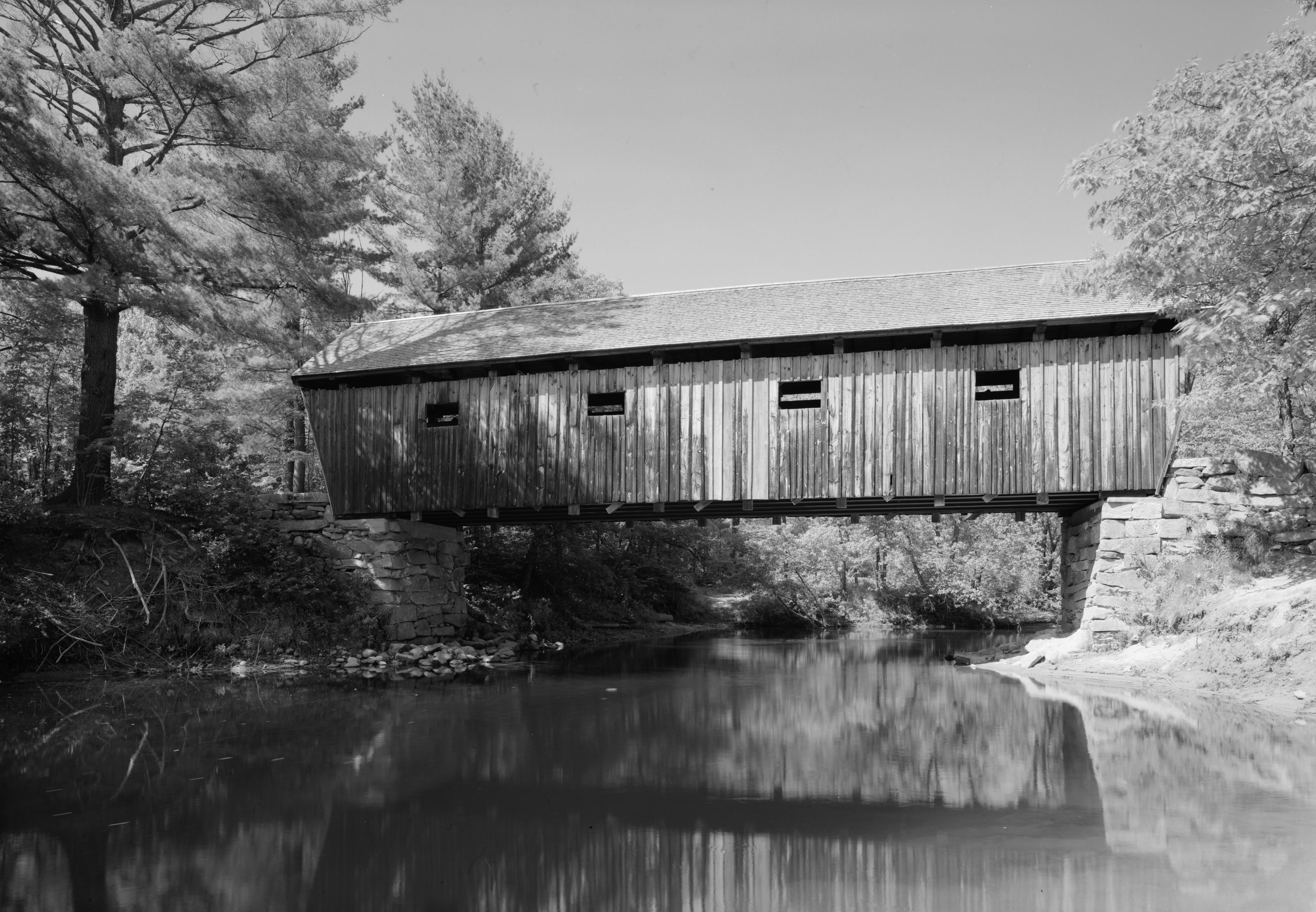
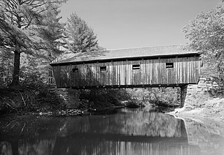
This is an image of a place or building that is listed on the National Register of Historic Places in the United States of America. Its reference number is 70000057. |
| Camera location | | View this and other nearby images on: OpenStreetMap |
|---|
| تفصیل |
English: Side of the Lovejoy Bridge, which spans the Ellis River in South Andover, Maine, United States. Built in 1868, it is listed on the National Register of Historic Places. |
|||||||||||||||||||||||
| تاریخ | ||||||||||||||||||||||||
| ماخذ | Library of Congress, Prints and Photograph Division HAER: ME,9-AND,1-1 | |||||||||||||||||||||||
| مصنف |
|
|||||||||||||||||||||||
| اجازت (فائل کا دوبارہ استعمال) |
|
|||||||||||||||||||||||
.jpg)

|
This image is available from the United States Library of Congress's Prints and Photographs division
under the digital ID hhh.me0196. This tag does not indicate the copyright status of the attached work. A normal copyright tag is still required. See Commons:Licensing.
|
فائل کا تاریخچہ
کسی خاص وقت یا تاریخ میں یہ فائل کیسی نظر آتی تھی، اسے دیکھنے کے لیے اس وقت/تاریخ پر کلک کریں۔
| تاریخ/وقت | تھمب نیل | ابعاد | صارف | تبصرہ | |
|---|---|---|---|---|---|
| رائج الوقت | 02:26، 8 جنوری 2010ء | | 4,597 × 3,186 (1.72 MB) | Nyttend | {{Location|44|35|37|N|70|44|2|W}} {{Information |Description={{en|Side of the {{w|Lovejoy Bridge}}, which spans the {{w|Ellis River (Maine)|Ellis River}} in {{w|Andover, Maine|South Andover}}, {{w|Maine}}, {{w|United States}}. Built in 1868, it is listed |
روابط
اس فائل سے مربوط کوئی صفحہ موجود نہیں ہے۔
فائل کا عالمی استعمال
مندرجہ ذیل ویکیوں میں یہ فائل زیر استعمال ہے:
- ceb.wikipedia.org پر استعمال
- de.wikipedia.org پر استعمال
- en.wikipedia.org پر استعمال
- www.wikidata.org پر استعمال