
فائل:Malay language Spoken Area Map v1.png
اس سے زیادہ ریزولیوشن دستیاب نہیں۔
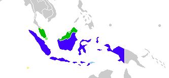
Malay_language_Spoken_Area_Map_v1.png (333 × 154 پکسل، فائل کا حجم: 4 کلوبائٹ، MIME قسم: image/png)
خلاصہ

|
This linguistic map image could be re-created using vector graphics as an SVG file. This has several advantages; see Commons:Media for cleanup for more information. If an SVG form of this image is available, please upload it and afterwards replace this template with
{{vector version available|new image name}}.
It is recommended to name the SVG file “Malay language Spoken Area Map v1.svg”—then the template Vector version available (or Vva) does not need the new image name parameter. |
| تفصیل |
English: This is crop and edit of a .png export of the image at File:BlankMap-World6.svg. The original author released that image into the public domain for any use. This version is released under the CC-Zero license. |
| تاریخ | 13 فروری 2011 (original upload date) |
| ماخذ | Transferred from en.wikipedia to Commons by Zscout370 using CommonsHelper. |
| مصنف | True at انگریزی ویکیپیڈیا |
اجازہ کاری
اس تخلیقی کام کے حقوق کا مالک True at انگریزی ویکیپیڈیا اسے مندرجہ ذیل اجازت نامے کے تحت شائع کرتا ہے:
| This file is made available under the Creative Commons CC0 1.0 Universal Public Domain Dedication. | |
| The person who associated a work with this deed has dedicated the work to the public domain by waiving all of their rights to the work worldwide under copyright law, including all related and neighboring rights, to the extent allowed by law. You can copy, modify, distribute and perform the work, even for commercial purposes, all without asking permission.
|
اولین اپلوڈ کا نوشتہ
فائل کی تفصیلات کا اصل صفحہ یہاں تھا۔ درج ذیل تمام صارفین en.wikipedia کے ہیں۔
- 2012-02-20 03:34 Kwamikagami 333×154× (4555 bytes) correct area in Thailand, add Cocos Isl.
- 2012-02-20 03:17 Kwamikagami 333×154× (4570 bytes) Reverted to version as of 23:23, 13 February 2011
- 2011-09-14 23:58 Niduzzi 736×386× (33038 bytes)
- 2011-02-13 23:23 True 333×154× (4570 bytes) This is crop and edit of a .png export of the image at http://en.wikipedia.org/wiki/File:BlankMap-World6.svg. The original author released that image into the public domain for any use. This version is released under the CC-Zero license.
فائل کا تاریخچہ
کسی خاص وقت یا تاریخ میں یہ فائل کیسی نظر آتی تھی، اسے دیکھنے کے لیے اس وقت/تاریخ پر کلک کریں۔
| تاریخ/وقت | تھمب نیل | ابعاد | صارف | تبصرہ | |
|---|---|---|---|---|---|
| رائج الوقت | 08:23، 25 فروری 2022ء | | 333 × 154 (4 کلوبائٹ) | Kwamikagami | no longer a map of where Malay is spoken |
| 05:52، 26 اکتوبر 2018ء |  | 4,387 × 1,922 (336 کلوبائٹ) | Bennylin | Edit some colors | |
| 05:40، 26 اکتوبر 2018ء |  | 4,300 × 1,918 (535 کلوبائٹ) | Bennylin | Change ugly map with PNG version of File:Maritime South East Asia.svg | |
| 04:51، 21 جون 2012ء |  | 333 × 154 (4 کلوبائٹ) | File Upload Bot (Magnus Manske) | Transfered from en.wikipedia by User:zscout370 using CommonsHelper |
روابط
اس فائل سے مربوط کوئی صفحہ موجود نہیں ہے۔
فائل کا عالمی استعمال
مندرجہ ذیل ویکیوں میں یہ فائل زیر استعمال ہے:
- ckb.wikipedia.org پر استعمال
- el.wikipedia.org پر استعمال
- en.wikipedia.org پر استعمال
- es.wikipedia.org پر استعمال
- fa.wikipedia.org پر استعمال
- frr.wikipedia.org پر استعمال
- id.wikipedia.org پر استعمال
- incubator.wikimedia.org پر استعمال
- mi.wikipedia.org پر استعمال
- nl.wikipedia.org پر استعمال
- zh.wikipedia.org پر استعمال