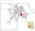
فائل:Maricopa County Incorporated and Planning areas Tempe highlighted.svg

اس SVG فائل کی PNG نمائش کا حجم: 694 × 599 پکسلز دیگر تصمیمات: 278 × 240 پکسلز | 556 × 480 پکسلز | 889 × 768 پکسلز | 1,185 × 1,024 پکسلز | 2,371 × 2,048 پکسلز | 940 × 812 پکسلز۔
اصل فائل (ایس وی جی فائل، ابعاد 940 × 812 پکسل، فائل کا حجم: 1.05 MB)
فائل کا تاریخچہ
کسی خاص وقت یا تاریخ میں یہ فائل کیسی نظر آتی تھی، اسے دیکھنے کے لیے اس وقت/تاریخ پر کلک کریں۔
| تاریخ/وقت | تھمب نیل | ابعاد | صارف | تبصرہ | |
|---|---|---|---|---|---|
| رائج الوقت | 06:49، 20 مئی 2011ء |  | 940 × 812 (1.05 MB) | Ixnayonthetimmay | Uploading new version |
| 04:49، 30 اگست 2008ء |  | 900 × 800 (424 کلوبائٹ) | Ixnayonthetimmay | == Summary == {{Information |Description=This map shows the incorporated areas and unincorporated areas in Maricopa County, Arizona. [[:en:Sunflower, Arizona | |
| 23:55، 15 ستمبر 2007ء |  | 900 × 800 (384 کلوبائٹ) | Ixnayonthetimmay | == Summary == {{Information |Description=This map shows the incorporated areas in Maricopa County, Arizona. It also shows the boundaries for the municipal planning areas. The [[:en:Fort | |
| 10:16، 28 مئی 2007ء |  | 900 × 780 (329 کلوبائٹ) | Ixnayonthetimmay | ||
| 01:27، 22 مئی 2007ء |  | 900 × 780 (318 کلوبائٹ) | Ixnayonthetimmay | ||
| 05:29، 30 جنوری 2007ء |  | 904 × 758 (177 کلوبائٹ) | Ixnayonthetimmay | {{Information |Description=This map shows the incorporated areas in Maricopa County, Arizona, highlighting Tempe in red. It also shows the boundaries for the munic |
روابط
درج ذیل صفحہ اس فائل کو استعمال کر رہا ہے:
فائل کا عالمی استعمال
مندرجہ ذیل ویکیوں میں یہ فائل زیر استعمال ہے:
- ar.wikipedia.org پر استعمال
- arz.wikipedia.org پر استعمال
- br.wikipedia.org پر استعمال
- ca.wikipedia.org پر استعمال
- ceb.wikipedia.org پر استعمال
- de.wikipedia.org پر استعمال
- el.wikipedia.org پر استعمال
- eo.wikipedia.org پر استعمال
- eu.wikipedia.org پر استعمال
- fa.wikipedia.org پر استعمال
- fi.wikipedia.org پر استعمال
- fr.wikipedia.org پر استعمال
- ga.wikipedia.org پر استعمال
- ht.wikipedia.org پر استعمال
- hu.wikipedia.org پر استعمال
- id.wikipedia.org پر استعمال
- ja.wikipedia.org پر استعمال
- kw.wikipedia.org پر استعمال
- pt.wikipedia.org پر استعمال
- ro.wikipedia.org پر استعمال
- sv.wikipedia.org پر استعمال
- sw.wikipedia.org پر استعمال
- tr.wikipedia.org پر استعمال
- tt.wikipedia.org پر استعمال
- vo.wikipedia.org پر استعمال
- www.wikidata.org پر استعمال
