
فائل:Mediterranean Sea political map-blank.svg

اس SVG فائل کی PNG نمائش کا حجم: 800 × 585 پکسلز دیگر تصمیمات: 320 × 234 پکسلز | 640 × 468 پکسلز | 1,024 × 749 پکسلز | 1,280 × 936 پکسلز | 2,560 × 1,872 پکسلز | 2,046 × 1,496 پکسلز۔
اصل فائل (ایس وی جی فائل، ابعاد 2,046 × 1,496 پکسل، فائل کا حجم: 1.06 MB)
خلاصہ
| تفصیل |
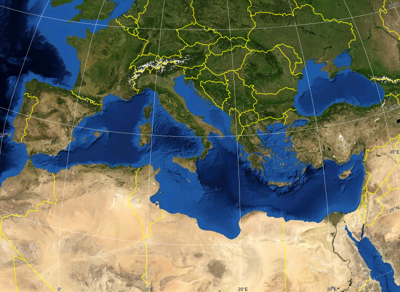
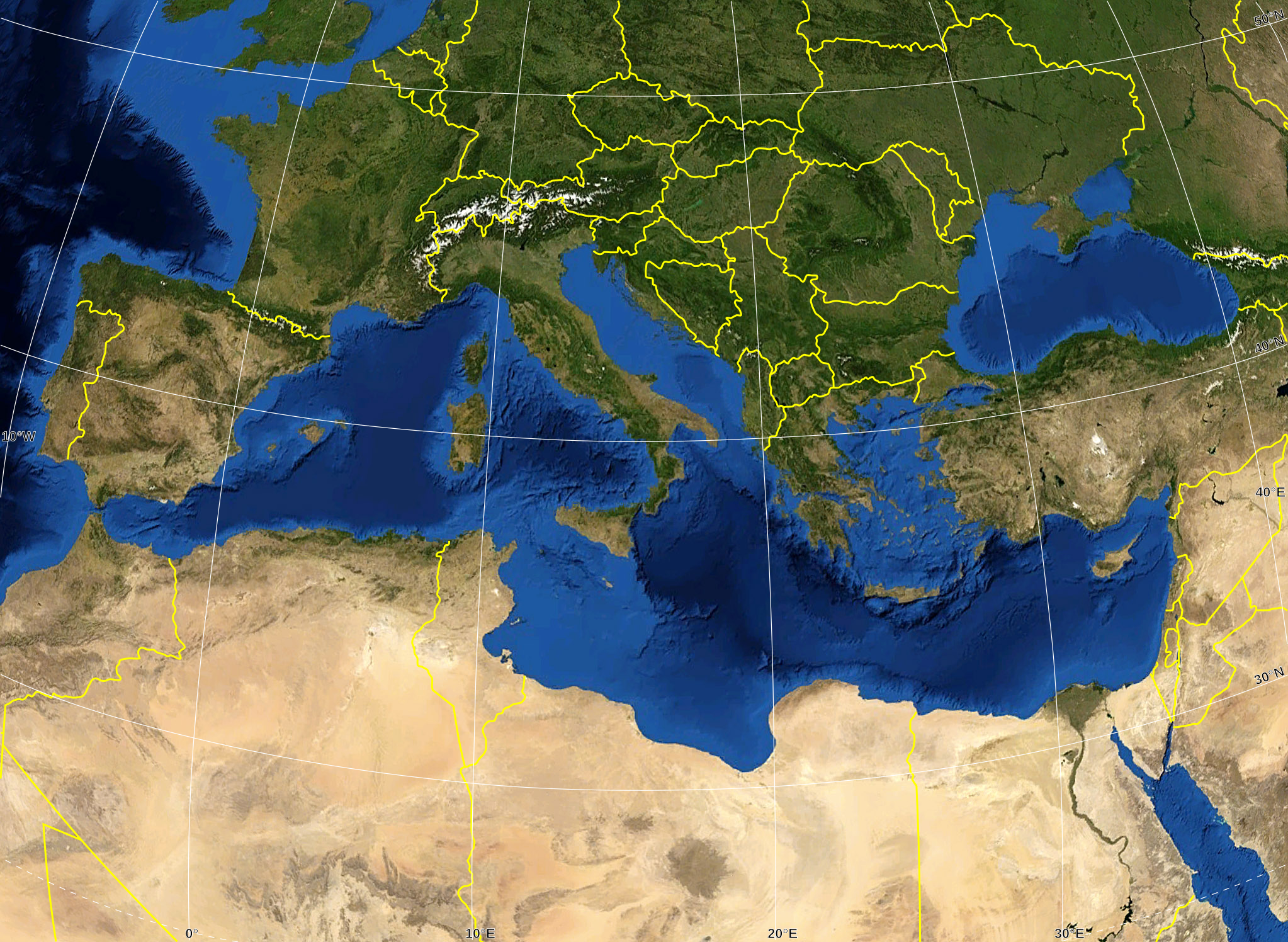
English: Blank map of the Mediterranean Sea, with the State borders.
Français : Carte vierge de la Mer Méditerranée avec les frontières nationales. |
| تاریخ | |
| ماخذ |
Own work ; Raster background map : screenshot from NASA World Wind (Public Domain) |
| مصنف | Eric Gaba (Sting - fr:Sting) |
| اجازت (فائل کا دوبارہ استعمال) |
All rights released |
| دوسرے نسخے |
Derivative works of this file: Delian League Campaign Map.png
|


اجازہ کاری
| This image is in the public domain because it is a screenshot from NASA’s globe software World Wind using a public domain layer, such as Blue Marble, MODIS, Landsat, SRTM, USGS or GLOBE.
|
 |
| This work was previously under Public Domain, or a Free License. It has been digitally enhanced and/or modified. This derivative work has been (or is hereby) released into the public domain by its author, Sting at the French Wikipedia project. This applies worldwide. In some countries this is not legally possible; if so:
|
فائل کا تاریخچہ
کسی خاص وقت یا تاریخ میں یہ فائل کیسی نظر آتی تھی، اسے دیکھنے کے لیے اس وقت/تاریخ پر کلک کریں۔
| تاریخ/وقت | تھمب نیل | ابعاد | صارف | تبصرہ | |
|---|---|---|---|---|---|
| رائج الوقت | 16:14، 19 مئی 2008ء | | 2,046 × 1,496 (1.06 MB) | Sting | "Tropic of Cancer" label correction |
| 01:07، 21 جون 2007ء |  | 2,046 × 1,496 (1.06 MB) | Sting | {{Information |Description=Blank map of the Mediterranean Sea, with the State borders. |Source=Own work ;<br/>Background map : screenshot from NASA World Wind (Public Domain) |Date=June 2007 |Author=Eric Gaba ([[User:Sting|Sting] |
روابط
اس فائل سے مربوط کوئی صفحہ موجود نہیں ہے۔
فائل کا عالمی استعمال
مندرجہ ذیل ویکیوں میں یہ فائل زیر استعمال ہے:
- ar.wikipedia.org پر استعمال
- fr.wikipedia.org پر استعمال
- gv.wikipedia.org پر استعمال
- id.wikipedia.org پر استعمال
- pl.wiktionary.org پر استعمال