
فائل:MountDutton.jpg
اس نمائش کا حجم: 800 × 534 پکسلز۔ دیگر تصمیمات: 320 × 214 پکسلز | 640 × 428 پکسلز | 1,024 × 684 پکسلز۔
اصل فائل (1,024 × 684 پکسل، فائل کا حجم: 151 کلوبائٹ، MIME قسم: image/jpeg)
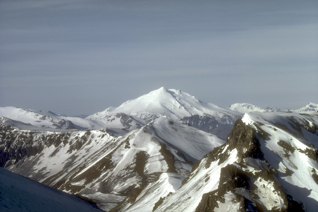
Mount Dutton, a 1,506-m (4,941 ft)-high stratovolcano, lies 14 km (9 mi) north of the community of King Cove on the Alaska Peninsula. The summit of Mount Dutton is composed of a cluster of lava domes. Mount Dutton has had no historical eruptions. However, seismic swarms beneath the volcano were recorded in 1984 to 1985 and again in 1989. View is to the southwest.
Photograph by M.E. Yount, U.S. Geological Survey, July, 1986.
Source: http://geopubs.wr.usgs.gov/dds/dds-40/
This image is in the public domain in the United States because it only contains materials that originally came from the United States Geological Survey, an agency of the United States Department of the Interior. For more information, see the official USGS copyright policy.
|
فائل کا تاریخچہ
کسی خاص وقت یا تاریخ میں یہ فائل کیسی نظر آتی تھی، اسے دیکھنے کے لیے اس وقت/تاریخ پر کلک کریں۔
| تاریخ/وقت | تھمب نیل | ابعاد | صارف | تبصرہ | |
|---|---|---|---|---|---|
| رائج الوقت | 09:21، 27 جنوری 2005ء | | 1,024 × 684 (151 کلوبائٹ) | GarciaB~commonswiki | Mount Dutton, Alaska |
روابط
درج ذیل صفحہ اس فائل کو استعمال کر رہا ہے:
فائل کا عالمی استعمال
مندرجہ ذیل ویکیوں میں یہ فائل زیر استعمال ہے:
- arz.wikipedia.org پر استعمال
- ca.wikipedia.org پر استعمال
- ceb.wikipedia.org پر استعمال
- cs.wikipedia.org پر استعمال
- de.wikipedia.org پر استعمال
- en.wikipedia.org پر استعمال
- lld.wikipedia.org پر استعمال
- ms.wikipedia.org پر استعمال
- no.wikipedia.org پر استعمال
- ru.wikipedia.org پر استعمال
- www.wikidata.org پر استعمال
- zh.wikipedia.org پر استعمال