
فائل:Old Street Roundabout - geograph.org.uk - 1758354.jpg
اس نمائش کا حجم: 800 × 600 پکسلز۔ دیگر تصمیمات: 320 × 240 پکسلز | 640 × 480 پکسلز | 1,024 × 768 پکسلز | 1,280 × 960 پکسلز۔
اصل فائل (1,280 × 960 پکسل، فائل کا حجم: 167 کلوبائٹ، MIME قسم: image/jpeg)
خلاصہ
| تفصیل |
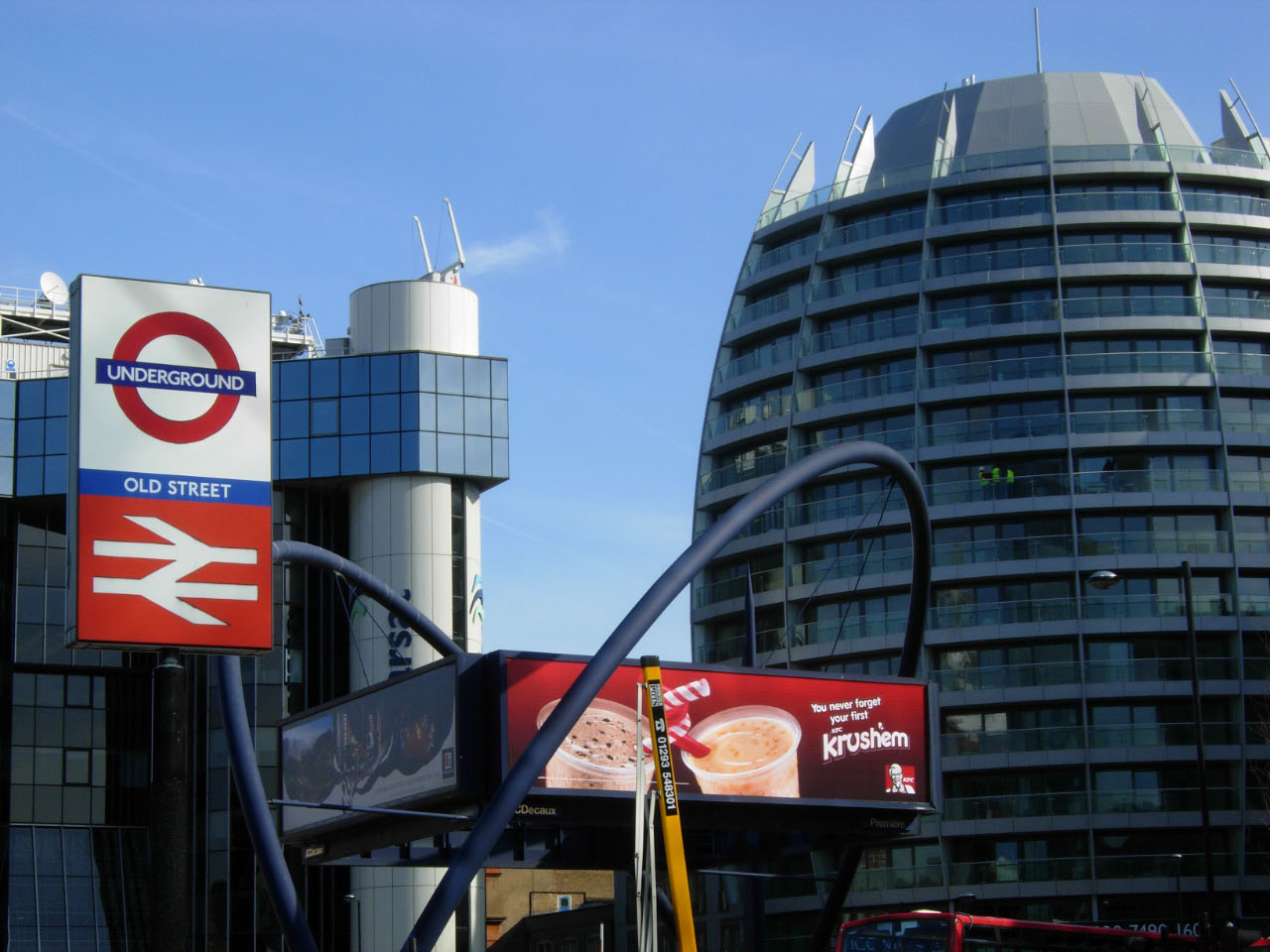
English: Old Street Roundabout This location, where Old Street crosses City Road, is a 'development hotspot' on the northern fringe of the City. In this view the modernistic Inmarsat Building and one of the egg-shaped Bezier Development blocks can be seen. In the centre of the roundabout the double arch structure that supports advertising hoardings was designed by Hanscomb Davies and erected in 1993. Old Street station is served by the Northern Line and by National Rail services to and from Moorgate. |
| تاریخ | |
| ماخذ | From geograph.org.uk |
| مصنف | Stephen McKay |
| لگاؤ (required by the license) | Stephen McKay / Old Street Roundabout / |
| Camera location | | View this and other nearby images on: OpenStreetMap |
|---|
_heading:112.00&language=ur)
| Object location | | View this and other nearby images on: OpenStreetMap |
|---|
_heading:112.00&language=ur)
اجازہ کاری

|
This image was taken from the Geograph project collection. See this photograph's page on the Geograph website for the photographer's contact details. The copyright on this image is owned by Stephen McKay and is licensed for reuse under the Creative Commons Attribution-ShareAlike 2.0 license.
|
This file is licensed under the Creative Commons Attribution-Share Alike 2.0 Generic license.
لگاؤ: Stephen McKay
- آپ آزاد ہیں:
- شیئر کرنے – کام کو نقل، تقسیم یا منتقل کرنے کے لیے
- ریمکس کے لیے – کام منبطق کرنے کے لیے
- مندرجہ ذیل شرائط کے تحت:
- انتساب – آپ کو اس کام کا انتساب مصنف یا اجازت دہندہ کے بتائے گئے طریقہ کے مطابق دینا ہوگا (تاہم یہ انتساب اس طرح نہیں ہونا چاہیے کہ اسے دیکھ کر ایسا محسوس ہو کہ اصل مصنف یا اجازت دہندہ آپ کے یا آپ کے ذریعہ اس کام کے استعمال کرنے کے حامی ہیں)۔
- یکساں شراکت – اگر آپ اس کام میں کوئی تبدیلی یا ترمیم کرتے ہیں یا اس کام پر مبنی کچھ نیا بناتے ہیں تو اسے بھی آپ اسی یا اس جیسے کسی اجازت نامے کے تحت شائع کر سکتے ہیں۔
فائل کا تاریخچہ
کسی خاص وقت یا تاریخ میں یہ فائل کیسی نظر آتی تھی، اسے دیکھنے کے لیے اس وقت/تاریخ پر کلک کریں۔
| تاریخ/وقت | تھمب نیل | ابعاد | صارف | تبصرہ | |
|---|---|---|---|---|---|
| رائج الوقت | 23:47، 5 مارچ 2011ء | | 1,280 × 960 (167 کلوبائٹ) | GeographBot | == {{int:filedesc}} == {{Information |description={{en|1=Old Street Roundabout This location, where Old Street crosses City Road, is a 'development hotspot' on the northern fringe of the City. In this view the modernistic Inmarsat Building and one of the |
روابط
درج ذیل صفحہ اس فائل کو استعمال کر رہا ہے: