
فائل:PikiWiki Israel 16194 kiryat gat.jpg

اس نمائش کا حجم: 799 × 599 پکسلز۔ دیگر تصمیمات: 320 × 240 پکسلز | 640 × 480 پکسلز | 1,024 × 768 پکسلز | 1,280 × 960 پکسلز | 1,682 × 1,262 پکسلز۔
اصل فائل (1,682 × 1,262 پکسل، فائل کا حجم: 2.83 MB، MIME قسم: image/jpeg)
| تفصیل |
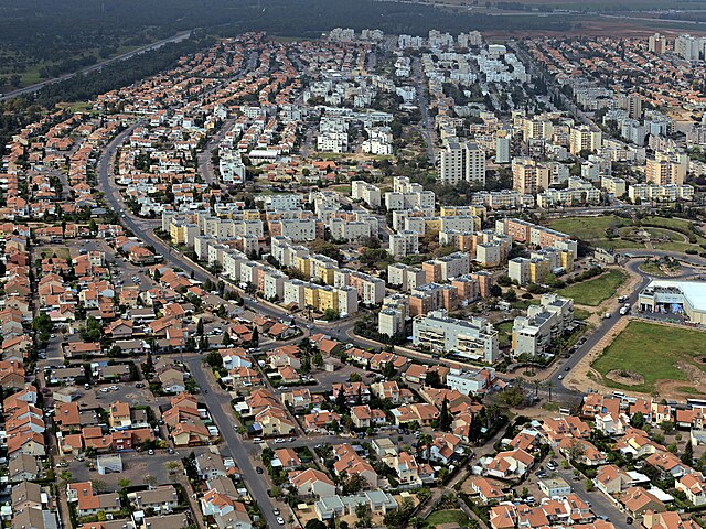
English: kiryat gat, Geography of Israel עברית: תצלום אווירי על הצד המערבי של העיר קרית גת, Original Image Name:תצלום אווירי, Location:קרית גת |
| تاریخ | قریباً 2010 |
| ماخذ | Lehava Center Qiryat Gat via the PikiWiki - Israel free image collection project |
| مصنف | ארכיון קרית גת |
| اجازت (فائل کا دوبارہ استعمال) |
This file is licensed under the Creative Commons Attribution 2.5 Generic license. لگاؤ: ארכיון קרית גת
|

|
This file has been submitted through the Israeli Pikiwiki project and uploaded here automatically.
The project is cooperation between the Israel Internet Association and Wikimedia Israel in an effort to promote the concept of free content on the Web, by creating an image collection of digital-format, good quality photographs, documenting events relating to the history of Israel, or depicting places of distinction in Israel and the Middle East. The Pikiwiki Project is managed from 2021 by the "Heritage Stones" group.
Please consider notifying the project before renaming or deleting this file. Further information about the project can be found on the commons-l mailing list.
|
فائل کا تاریخچہ
کسی خاص وقت یا تاریخ میں یہ فائل کیسی نظر آتی تھی، اسے دیکھنے کے لیے اس وقت/تاریخ پر کلک کریں۔
| تاریخ/وقت | تھمب نیل | ابعاد | صارف | تبصرہ | |
|---|---|---|---|---|---|
| رائج الوقت | 13:13، 1 جنوری 2012ء | | 1,682 × 1,262 (2.83 MB) | Pikiwikisrael | {{Information |Description={{en|kiryat gat, Geography of Israel}} {{he|תצלום אווירי על הצד המערבי של העיר קרית גת, Original Image Name:תצלום אווירי, Location:קרית גת}} |Source=Lehava Center Qiryat Gat vi |
روابط
درج ذیل صفحہ اس فائل کو استعمال کر رہا ہے:
فائل کا عالمی استعمال
مندرجہ ذیل ویکیوں میں یہ فائل زیر استعمال ہے:
- ar.wikipedia.org پر استعمال
- arz.wikipedia.org پر استعمال
- ca.wikipedia.org پر استعمال
- ceb.wikipedia.org پر استعمال
- el.wikipedia.org پر استعمال
- en.wikipedia.org پر استعمال
- es.wikipedia.org پر استعمال
- fa.wikipedia.org پر استعمال
- fi.wikipedia.org پر استعمال
- he.wikipedia.org پر استعمال
- hi.wikipedia.org پر استعمال
- hy.wikipedia.org پر استعمال
- id.wikipedia.org پر استعمال
- ie.wikipedia.org پر استعمال
- it.wikipedia.org پر استعمال
- ja.wikipedia.org پر استعمال
- ka.wikipedia.org پر استعمال
- ko.wikipedia.org پر استعمال
- mn.wikipedia.org پر استعمال
- nl.wikipedia.org پر استعمال
- nn.wikipedia.org پر استعمال
- no.wikipedia.org پر استعمال
- pnb.wikipedia.org پر استعمال
- ru.wikipedia.org پر استعمال
- simple.wikipedia.org پر استعمال
- sr.wikipedia.org پر استعمال
- ta.wikipedia.org پر استعمال
- tr.wikipedia.org پر استعمال
- uk.wikipedia.org پر استعمال
- www.wikidata.org پر استعمال
- yi.wikipedia.org پر استعمال
- zh.wikipedia.org پر استعمال