
فائل:Turkey Istanbul location map.svg

اصل فائل (ایس وی جی فائل، ابعاد 1,568 × 845 پکسل، فائل کا حجم: 424 کلوبائٹ)
خلاصہ
| تفصیل |
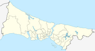
Geographische Begrenzung der Karte:
Geographic limits of the map:
|
| تاریخ | |
| ماخذ |
Own work using: File:Istanbul location districts.svg by |
| مصنف | NordNordWest |

|
This map has been made or improved in the German Kartenwerkstatt (Map Lab). You can propose maps to improve as well.
|
اجازہ کاری
Usage of this file with:

explanatory notes: Legally binding is only the full legalcode. For a free usage I recommend to respect the following licence conditions:
1. Provide my name as given above: NordNordWest,
2. a copy of, or the URI for, the applicable license: https://creativecommons.org/licenses/by-sa/3.0/de/legalcode,
3. the title of the work,
4. in the case of an adaptation, a credit identifying the use of the work in the adaptation.
This license and the rights granted hereunder will terminate automatically upon any breach by you of the terms of this license. Any of the above conditions can be waived if you get permission from the copyright holder. If you have questions or wish differing conditions, please contact me through nnwest or my discussion page ![]() t-online.de
t-online.de
- آپ آزاد ہیں:
- شیئر کرنے – کام کو نقل، تقسیم یا منتقل کرنے کے لیے
- ریمکس کے لیے – کام منبطق کرنے کے لیے
- مندرجہ ذیل شرائط کے تحت:
- انتساب – آپ کو اس کام کا انتساب مصنف یا اجازت دہندہ کے بتائے گئے طریقہ کے مطابق دینا ہوگا (تاہم یہ انتساب اس طرح نہیں ہونا چاہیے کہ اسے دیکھ کر ایسا محسوس ہو کہ اصل مصنف یا اجازت دہندہ آپ کے یا آپ کے ذریعہ اس کام کے استعمال کرنے کے حامی ہیں)۔
- یکساں شراکت – اگر آپ اس کام میں کوئی تبدیلی یا ترمیم کرتے ہیں یا اس کام پر مبنی کچھ نیا بناتے ہیں تو اسے بھی آپ اسی یا اس جیسے کسی اجازت نامے کے تحت شائع کر سکتے ہیں۔

فائل کا تاریخچہ
کسی خاص وقت یا تاریخ میں یہ فائل کیسی نظر آتی تھی، اسے دیکھنے کے لیے اس وقت/تاریخ پر کلک کریں۔
| تاریخ/وقت | تھمب نیل | ابعاد | صارف | تبصرہ | |
|---|---|---|---|---|---|
| رائج الوقت | 17:26، 6 اپریل 2018ء | | 1,568 × 845 (424 کلوبائٹ) | NordNordWest | upd |
| 11:37، 16 اگست 2014ء |  | 1,568 × 845 (465 کلوبائٹ) | NordNordWest | == {{int:filedesc}} == {{Information |Description= {{de|Positionskarte der Provinz Istanbul, Türkei}} Geographische Begrenzung der Karte: * N: 41.619888° N * S: 40.796666° N * W: 27.941666° O * O: 29.97388... |
روابط
درج ذیل 16 صفحات اس فائل کو استعمال کر رہے ہیں:
- استنبول صبیحہ گوکچن بین الاقوامی ہوائی اڈا
- استنبول ہوائی اڈا
- انادولوکاواغی
- باہچےکوئے، سارییر
- بوستانجی
- بیشکتاش
- حسین رحمی گورپینار عجائب گھر
- روم ایلی کاواغی
- ریوا، استنبول
- صوقلو محمد پاشا مسجد، بویوک چکمہجے
- عجیب آدم، قاضی کوئے
- عصمت انونو منزل عجائب گھر
- غریبچے، استنبول
- پاشا بچہ، بیکوز
- پویرازکوئے
- کوشویولوم قاضی کوئے
فائل کا عالمی استعمال
مندرجہ ذیل ویکیوں میں یہ فائل زیر استعمال ہے:
- ar.wikipedia.org پر استعمال
- azb.wikipedia.org پر استعمال
- az.wikipedia.org پر استعمال
- Ayasofiya
- Topqapı sarayı
- Əyyub Sultan məscidi
- Sultan Əhməd məscidi
- Zal Mahmud paşa məscidi
- Ulduz sarayı
- Laləli məscidi
- Yavuz Sultan Səlim külliyəsi
- Bəyazid məscidi
- İbrahim Paşa Sarayı
- Ulduz Saat Qülləsi
- Abdi İpəkçi sui-qəsdi
- Rumeli Hasarı
- Yeni məscid (İstanbul)
- Mehrimah Sultan məscidi (Üsküdar)
- Haseki hamamı
- Ağa hamamı
- Dolmabağça saat qülləsi
- Topxana saat qülləsi
- Nuruosmaniyə məscidi
- Atatürk körpüsü
- Yeddiqüllə zindanları
- İstanbul Əşkinazi sinaqoqu
- Küçüksu sarayı
- Hidiv qəsri
- Səbətçilər sarayı
- İhlamur sarayı
- Florya Atatürk Dəniz Köşkü
- Çırağan sarayı
- Şablon:Yer xəritəsi Türkiyə İstanbul
- Fateh məscidi (İstanbul)
- Kiçik Vlaxerna sarayı
- İstanbul Hava Limanı
- Lütfü Kırdar Konqres və Sərgi Sarayı (İstanbul)
- Ulduz Həmidiyyə məscidi
- Böyük İstanbul avtovağzalı
- Türkiyə Super Liqası 2021/2022
- Türkiyə Super Liqası 2020/2021
- Türkiyə Super Liqası 2019/2020
- Türkiyə Super Liqası 2018/2019
- bn.wikipedia.org پر استعمال
اس فائل کا مزید عالمی استعمال دیکھیے۔