
فائل:USA Counties.svg

اس SVG فائل کی PNG نمائش کا حجم: 555 × 352 پکسلز دیگر تصمیمات: 320 × 203 پکسلز | 640 × 406 پکسلز | 1,024 × 649 پکسلز | 1,280 × 812 پکسلز | 2,560 × 1,624 پکسلز۔
اصل فائل (ایس وی جی فائل، ابعاد 555 × 352 پکسل، فائل کا حجم: 1.11 MB)

|
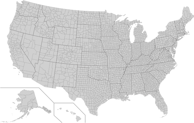
This file has been superseded by Usa counties large.svg. It is recommended to use the other file. Please note that deleting superseded images requires consent. Reason to use the other file: "Contains county names and county codes in the svg code"
|

|
| تفصیل |
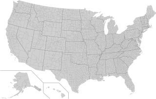
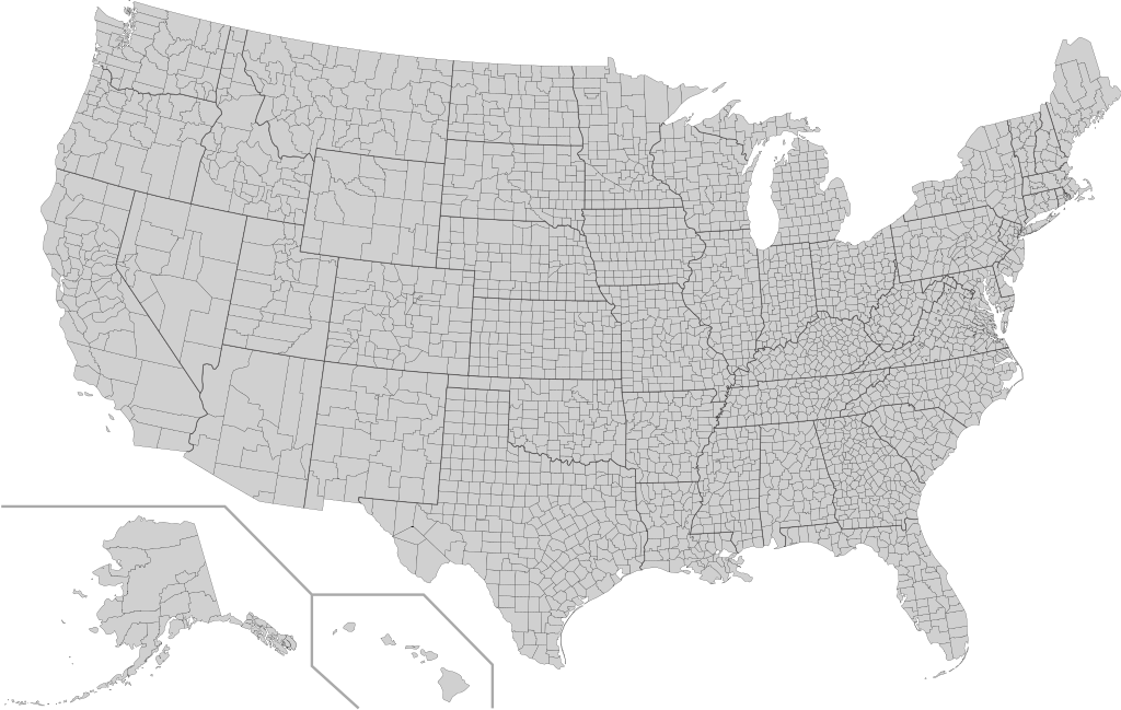
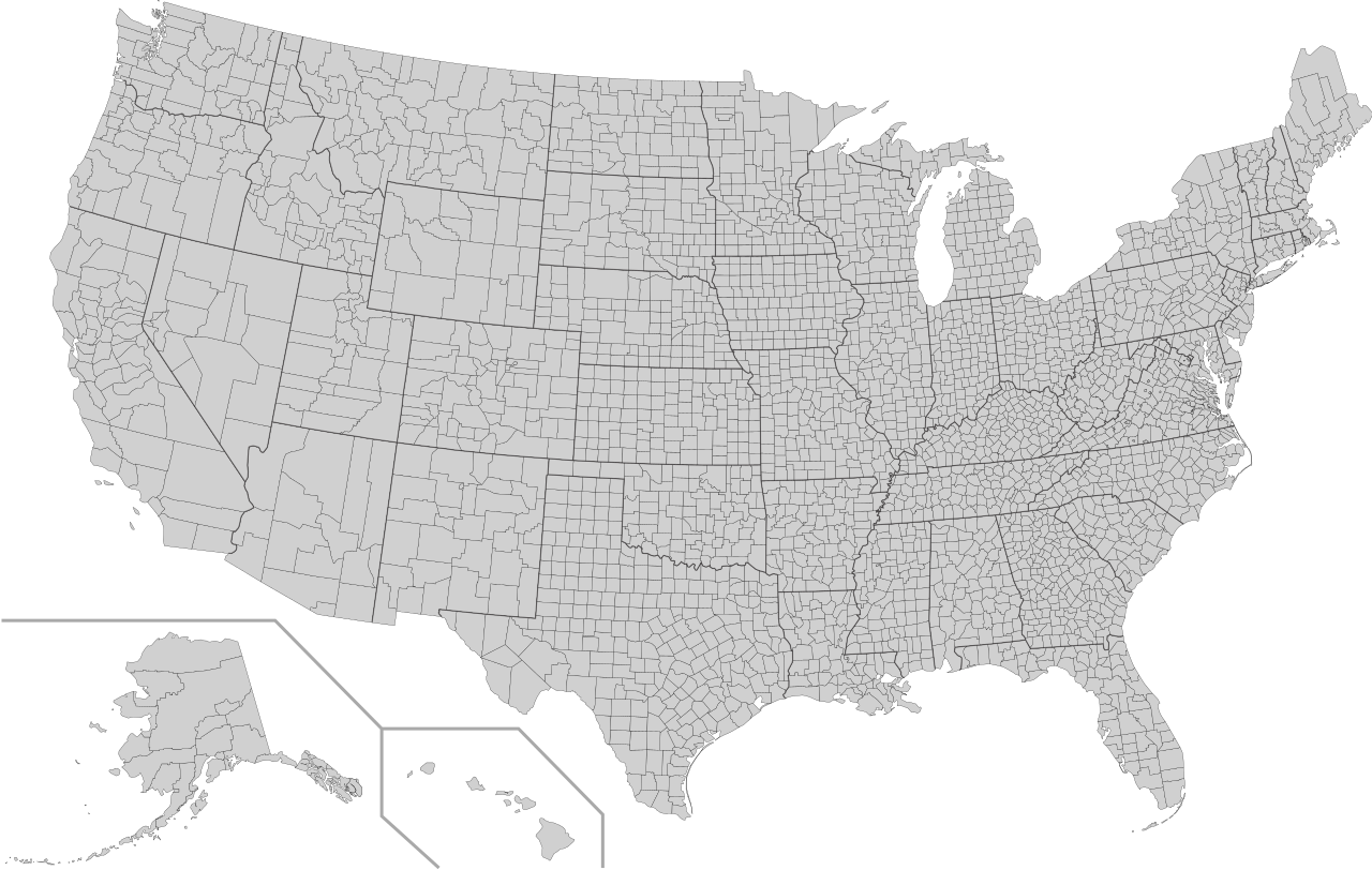
English: This is a map of the United States showing the borders of states and counties in high detail. |
|||
| ماخذ |
It was derived from this public-domain document published by the U.S. Census Bureau. |
|||
| مصنف | U.S. Census Bureau | |||
| اجازت (فائل کا دوبارہ استعمال) |
|
|||
| دوسرے نسخے | Derivative works of this file: Usa counties large.svg | |||
| SVG genesis |

فائل کا تاریخچہ
کسی خاص وقت یا تاریخ میں یہ فائل کیسی نظر آتی تھی، اسے دیکھنے کے لیے اس وقت/تاریخ پر کلک کریں۔
| تاریخ/وقت | تھمب نیل | ابعاد | صارف | تبصرہ | |
|---|---|---|---|---|---|
| رائج الوقت | 05:18، 10 اگست 2022ء | | 555 × 352 (1.11 MB) | DemonDays64 | Fixed some problems: merged southern part of Unorganized Alaska into one shape; properly labeled Somerset MD, which Accomack VA had been mislabeled as |
| 06:22، 17 ستمبر 2020ء |  | 555 × 352 (1.11 MB) | DemonDays64 | Fixed misspelling of "Albemarle" as "Albermarle" | |
| 15:56، 10 ستمبر 2018ء |  | 555 × 352 (1.11 MB) | JoKalliauer | restored id-names and css from 03:49, 26. Mär. 2016 | |
| 06:38، 30 اگست 2018ء |  | 555 × 352 (670 کلوبائٹ) | JoKalliauer | Smaller file-size. Cleaner code. valid file | |
| 03:49، 26 مارچ 2016ء |  | 555 × 352 (1.58 MB) | Spesh531 | updating borders, more accurate | |
| 15:47، 23 دسمبر 2007ء |  | 555 × 352 (2.03 MB) | Lokal Profil | Fixed state borders and fixed the two parts of Fulton County (Kentucky) | |
| 02:20، 10 دسمبر 2007ء |  | 555 × 352 (2.04 MB) | Lokal Profil | Graphical and code cleanup | |
| 01:15، 10 دسمبر 2007ء |  | 792 × 612 (2.04 MB) | Lokal Profil | First stab at a code cleanup | |
| 00:14، 29 اگست 2006ء |  | 792 × 612 (2.71 MB) | Petr Dlouhý | Original file: en:Image:USA CountiesSVG.zip This ZIP file contains an SVG map of the United States showing the borders of states and counties in high detail. It was derived from [http://www2.census.gov/geo/maps/special |
روابط
درج ذیل صفحہ اس فائل کو استعمال کر رہا ہے:
فائل کا عالمی استعمال
مندرجہ ذیل ویکیوں میں یہ فائل زیر استعمال ہے:
- af.wikipedia.org پر استعمال
- en.wikipedia.org پر استعمال
- fa.wikipedia.org پر استعمال
- fi.wikipedia.org پر استعمال
- he.wikipedia.org پر استعمال
- hi.wikipedia.org پر استعمال
- hu.wikipedia.org پر استعمال
- io.wikipedia.org پر استعمال
- pnb.wikipedia.org پر استعمال
- pt.wikipedia.org پر استعمال
- ro.wikipedia.org پر استعمال
- sh.wikipedia.org پر استعمال
- sq.wikipedia.org پر استعمال
- sr.wikipedia.org پر استعمال
- tr.wikipedia.org پر استعمال