
فائل:Union County Courthouse, La Grande, Oregon.jpg

اصل فائل (1,280 × 960 پکسل، فائل کا حجم: 164 کلوبائٹ، MIME قسم: image/jpeg)
خلاصہ
| تفصیل |
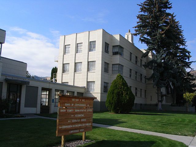
La Grande is a city in Union County, Oregon, United States.The population was 13,082 at the 2010 census. It is the county seat of Union County. La Grande lies east of the Blue Mountains and southeast of Pendleton. The Grande Ronde Valley had long been a waypoint along the Oregon Trail. The first permanent settler in the La Grande area was Benjamin Brown in 1861. La Grande was incorporated as a city in 1865, and platted in 1868. La Grande grew rapidly during the late 1860s and early 1870s, partially because of the many gold mines in the region and the valley's agricultural capabilities. The early business establishments centered on C Avenue between present day Fourth Street and the hillside on the west end. La Grande's Eastern Oregon University, formerly known as Eastern Oregon State College, began in 1929 as Eastern Oregon Normal School, a teachers college. La Grande had a factory for processing sugar beets into raw sugar. The sugar beets came from the nearby Mormon town of Nibley, Oregon, and both were owned by the Oregon Sugar Company. en.wikipedia.org/wiki/La_Grande,_Oregon en.wikipedia.org/wiki/Wikipedia:Text_of_Creative_Commons_... |
| تاریخ | |
| ماخذ | Union County Courthouse, La Grande, Oregon |
| مصنف | Ken Lund from Reno, Nevada, USA |
| Camera location | | View this and other nearby images on: OpenStreetMap |
|---|
اجازہ کاری
- آپ آزاد ہیں:
- شیئر کرنے – کام کو نقل، تقسیم یا منتقل کرنے کے لیے
- ریمکس کے لیے – کام منبطق کرنے کے لیے
- مندرجہ ذیل شرائط کے تحت:
- انتساب – آپ کو اس کام کا انتساب مصنف یا اجازت دہندہ کے بتائے گئے طریقہ کے مطابق دینا ہوگا (تاہم یہ انتساب اس طرح نہیں ہونا چاہیے کہ اسے دیکھ کر ایسا محسوس ہو کہ اصل مصنف یا اجازت دہندہ آپ کے یا آپ کے ذریعہ اس کام کے استعمال کرنے کے حامی ہیں)۔
- یکساں شراکت – اگر آپ اس کام میں کوئی تبدیلی یا ترمیم کرتے ہیں یا اس کام پر مبنی کچھ نیا بناتے ہیں تو اسے بھی آپ اسی یا اس جیسے کسی اجازت نامے کے تحت شائع کر سکتے ہیں۔
| This image was originally posted to Flickr by Ken Lund at https://flickr.com/photos/75683070@N00/265581433. It was reviewed on 23 جنوری 2016 by FlickreviewR and was confirmed to be licensed under the terms of the cc-by-sa-2.0. |
فائل کا تاریخچہ
کسی خاص وقت یا تاریخ میں یہ فائل کیسی نظر آتی تھی، اسے دیکھنے کے لیے اس وقت/تاریخ پر کلک کریں۔
| تاریخ/وقت | تھمب نیل | ابعاد | صارف | تبصرہ | |
|---|---|---|---|---|---|
| رائج الوقت | 04:23، 23 جنوری 2016ء | | 1,280 × 960 (164 کلوبائٹ) | Kingofthedead | Transferred from Flickr via Flickr2Commons |
روابط
درج ذیل صفحہ اس فائل کو استعمال کر رہا ہے:
فائل کا عالمی استعمال
مندرجہ ذیل ویکیوں میں یہ فائل زیر استعمال ہے:
- ar.wikipedia.org پر استعمال
- ceb.wikipedia.org پر استعمال
- ce.wikipedia.org پر استعمال
- cy.wikipedia.org پر استعمال
- eo.wikipedia.org پر استعمال
- es.wikipedia.org پر استعمال
- fr.wikipedia.org پر استعمال
- hu.wikipedia.org پر استعمال
- hy.wikipedia.org پر استعمال
- it.wikipedia.org پر استعمال
- ko.wikipedia.org پر استعمال
- no.wikipedia.org پر استعمال
- pl.wikipedia.org پر استعمال
- ru.wikipedia.org پر استعمال
- sr.wikipedia.org پر استعمال
- tr.wikipedia.org پر استعمال
- tt.wikipedia.org پر استعمال
- www.wikidata.org پر استعمال