
فائل:Zoarville Bridge.jpg
اس نمائش کا حجم: 439 × 600 پکسلز۔ دیگر تصمیمات: 176 × 240 پکسلز | 351 × 480 پکسلز | 562 × 768 پکسلز | 750 × 1,024 پکسلز | 1,499 × 2,048 پکسلز | 3,154 × 4,308 پکسلز۔
اصل فائل (3,154 × 4,308 پکسل، فائل کا حجم: 1.65 MB، MIME قسم: image/jpeg)
| Camera location | | View this and other nearby images on: OpenStreetMap |
|---|
|
This is an image of a place or building that is listed on the National Register of Historic Places in the United States of America. Its reference number is 97000199. |
| تفصیل |
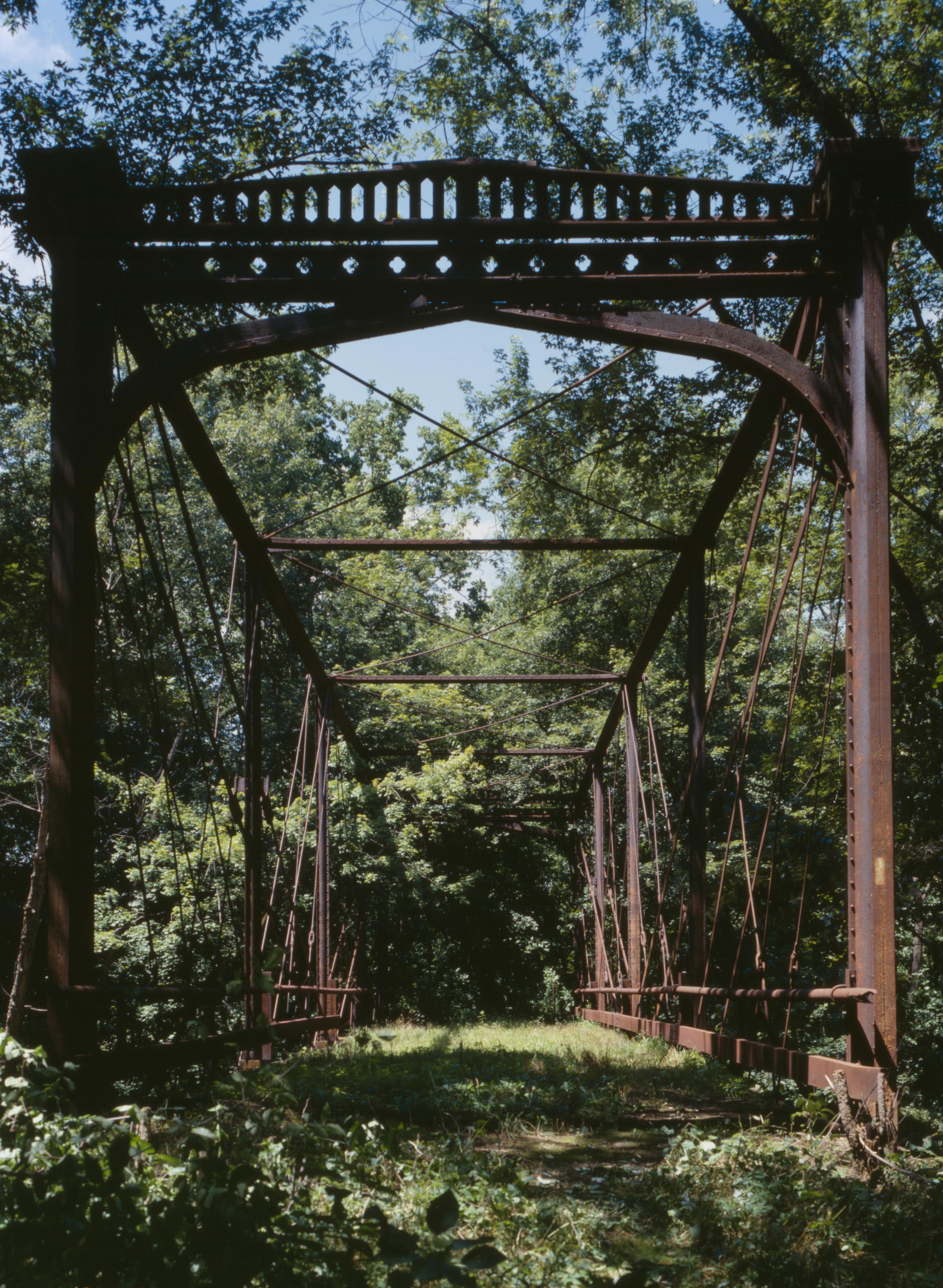
English: Southern end of the Zoarville Bridge, which spans Conotton Creek southeast of Zoarville in Fairfield Township, Tuscarawas County, Ohio, United States. Built in 1868 and listed on the National Register of Historic Places, it is the only Fink through truss bridge in the United States. |
||||
| تاریخ | |||||
| ماخذ |
Library of Congress, Prints and Photograph Division HAER: OHIO,79-ZOARV.V,1-18
|
||||
| مصنف | Joseph Elliott | ||||
| اجازت (فائل کا دوبارہ استعمال) |
|

فائل کا تاریخچہ
کسی خاص وقت یا تاریخ میں یہ فائل کیسی نظر آتی تھی، اسے دیکھنے کے لیے اس وقت/تاریخ پر کلک کریں۔
| تاریخ/وقت | تھمب نیل | ابعاد | صارف | تبصرہ | |
|---|---|---|---|---|---|
| رائج الوقت | 16:46، 27 اپریل 2009ء | | 3,154 × 4,308 (1.65 MB) | Martin H. | high res; cropped |
| 02:56، 26 اپریل 2009ء |  | 817 × 1,024 (329 کلوبائٹ) | Nyttend | {{Location|40|34|38|N|81|23|30|W}} {{Information |Description={{en|Southern end of the {{w|Zoarville Bridge}}, which spans Conotton Creek southeast of Zoarville in {{w|Fairfield Township, Tuscarawas County, Ohio|Fairfield Township}}, {{w|Tuscarawas County |
روابط
درج ذیل صفحہ اس فائل کو استعمال کر رہا ہے:
فائل کا عالمی استعمال
مندرجہ ذیل ویکیوں میں یہ فائل زیر استعمال ہے:
- en.wikipedia.org پر استعمال
- es.wikipedia.org پر استعمال
- eu.wikipedia.org پر استعمال
- fa.wikipedia.org پر استعمال
- pt.wikipedia.org پر استعمال
- vi.wikipedia.org پر استعمال
- www.wikidata.org پر استعمال
- zh.wikipedia.org پر استعمال