
فائل:Allegheny Monongahela Ohio.jpg
اس نمائش کا حجم: 800 × 508 پکسلز۔ دیگر تصمیمات: 320 × 203 پکسلز | 640 × 406 پکسلز | 1,024 × 650 پکسلز | 1,446 × 918 پکسلز۔
اصل فائل (1,446 × 918 پکسل، فائل کا حجم: 1.38 MB، MIME قسم: image/jpeg)
|
This is an image of a place or building that is listed on the National Register of Historic Places in the United States of America. Its reference number is 79003143. |
| تفصیل |
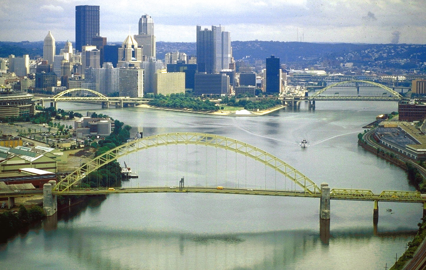
English: The source of the Ohio River at “The Point” in Point State Park, Pittsburgh, Pennsylvania.
|
|||
| تاریخ | ||||
| ماخذ |
U.S. Army Corps of Engineers Digital Visual Library Image page Image description page Digital Visual Library home page |
|||
| مصنف | David Schwab, U.S. Army Corps of Engineers | |||
| اجازت (فائل کا دوبارہ استعمال) |
|
|||
| Location | Pittsburgh, Pennsylvania, USA |
| Camera location | | View this and other nearby images on: OpenStreetMap |
|---|
| This is a retouched picture, which means that it has been digitally altered from its original version. Modifications: colors adjusted. Modifications made by Glabb.
|
فائل کا تاریخچہ
کسی خاص وقت یا تاریخ میں یہ فائل کیسی نظر آتی تھی، اسے دیکھنے کے لیے اس وقت/تاریخ پر کلک کریں۔
| تاریخ/وقت | تھمب نیل | ابعاد | صارف | تبصرہ | |
|---|---|---|---|---|---|
| رائج الوقت | 12:06، 25 جون 2010ء | | 1,446 × 918 (1.38 MB) | Glabb | colors adjusted |
| 00:31، 24 مارچ 2007ء |  | 1,446 × 918 (417 کلوبائٹ) | DanMS | {{Information | Description = {{en|The source of the Ohio River at “The Point” in Pittsburgh, Pennsylvania, USA. The Allegheny River (left) and the Monongahela River (right) join to form the Ohio here. The West End Bridge crosses the Ohio in the fo |
روابط
درج ذیل صفحہ اس فائل کو استعمال کر رہا ہے:
فائل کا عالمی استعمال
مندرجہ ذیل ویکیوں میں یہ فائل زیر استعمال ہے:
- ar.wikipedia.org پر استعمال
- ba.wikipedia.org پر استعمال
- bg.wikipedia.org پر استعمال
- bs.wikipedia.org پر استعمال
- da.wikipedia.org پر استعمال
- de.wikipedia.org پر استعمال
- el.wikipedia.org پر استعمال
- en.wikipedia.org پر استعمال
- City
- Ohio River
- Allegheny River
- List of crossings of the Ohio River
- West End (Pittsburgh)
- Confluence
- West End Bridge
- List of bridges of Pittsburgh
- National Register of Historic Places listings in Pittsburgh, Pennsylvania
- List of Pennsylvania state historical markers in Allegheny County
- User:OrdinaryGiraffe/Books/Vital/L2/A
- fa.wikipedia.org پر استعمال
- fo.wikipedia.org پر استعمال
- fr.wikipedia.org پر استعمال
- fy.wikipedia.org پر استعمال
- hy.wikipedia.org پر استعمال
- incubator.wikimedia.org پر استعمال
- it.wikipedia.org پر استعمال
- ja.wikipedia.org پر استعمال
- ka.wikipedia.org پر استعمال
- kn.wikipedia.org پر استعمال
- lt.wikipedia.org پر استعمال
- mr.wikipedia.org پر استعمال
- nl.wikipedia.org پر استعمال
- nn.wikipedia.org پر استعمال
- no.wikipedia.org پر استعمال
- pih.wikipedia.org پر استعمال
- pnb.wikipedia.org پر استعمال
- pt.wikipedia.org پر استعمال
- ru.wikipedia.org پر استعمال
- ru.wiktionary.org پر استعمال
- sr.wikipedia.org پر استعمال
- sv.wikipedia.org پر استعمال
اس فائل کا مزید عالمی استعمال دیکھیے۔