"سمرسیٹ" کے نسخوں کے درمیان فرق
حذف شدہ مندرجات اضافہ شدہ مندرجات
کوئی خلاصۂ ترمیم نہیں |
کوئی خلاصۂ ترمیم نہیں |
||
| سطر 1: | سطر 1: | ||
{{Infobox England county |
|||
| name = سامرسیٹ<br />Somerset |
|||
| image = [[File:Somnew.png|border|160px]] |
|||
| motto = Sumorsǣte ealle <br />''(''<nowiki>'</nowiki>All The People of Somerset<nowiki>'</nowiki>'') |
|||
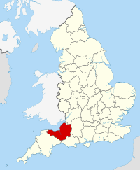
| map = [[File:Somerset UK locator map 2010.svg|200px|Somerset within England]] |
|||
| alt=Map of England and Wales showing the position of Somerset, shaded in red, in the northern area of the south west peninsula. |
|||
| status = [[انگلستان کی رسمی کاؤنٹیاں|رسمی]] اور (چھوٹی) غیر میٹروپولیٹن کاؤنٹی |
|||
| origin = تاریخی |
|||
| region = [[جنوب مغربی انگلستان]] |
|||
| arearank = [[فہرست انگلستان کی رسمی کاؤنٹیاں|ساتواں]] |
|||
| area_km2 = 4171 |
|||
| adminarearank = [[فہرست انگلستان کی رسمی کاؤنٹیاں|بارہواں]] |
|||
| adminarea_km2 = 3451 |
|||
| adminhq = [[ٹاونٹن]] |
|||
| iso = GB-SOM |
|||
| ons = 40 |
|||
| nuts3 = UKK23 |
|||
| poprank = [[List of ceremonial counties of England by population|درجہ {{English cerem counties|RNK=Somerset}}]] |
|||
| popestdate = {{English statistics year}} |
|||
| pop = {{English cerem counties|POP=Somerset}} |
|||
| density_km2 = {{English cerem counties|DEN=Somerset}} |
|||
| adminpoprank = [[List of non-metropolitan counties of England by population|درجہ {{English admin counties|RNK=Somerset}}]] |
|||
| adminpop = {{English admin counties|POP=Somerset}} |
|||
| ethnicity = 98.5% White |
|||
| council = [[File:Somerset county coat of arms.png]] |alt=Coat of arms with a yellow shield with a red dragon supported by a red deer and bull with yellow crowns around their necks, above these are a grey coloured helmet surmounted by a white goat<br />سومرسیٹ کاؤنٹی کونسل<br />http://www.somerset.gov.uk/irj/public |
|||
| exec = {{English county control|CTY=Somerset}} |
|||
| mps = *[[Jeremy Browne]] [[Liberal Democrats (UK)|(LD)]] |
|||
* [[Donald Foster (politician)|Don Foster]] (LD) |
|||
* [[Liam Fox]] [[Conservative Party (UK)|(C)]] |
|||
* [[David Heath (politician)|David Heath]] (LD) |
|||
* [[David Laws]] (LD) |
|||
* [[Ian Liddell-Grainger]] (C) |
|||
* [[Tessa Munt]] (LD) |
|||
* [[Jacob Rees-Mogg]] (C) |
|||
* [[John Penrose (politician)|John Penrose]] (C) |
|||
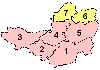
| subdivmap = [[File:Somerset Ceremonial Numbered2.gif]] |alt=map of the five non metropolitan districts and two unitary authorities in the ceremonial county |
|||
| subdivs = #[[جنوبی سامرسیٹ]] |
|||
# [[ٹاونٹن ڈین]] (بورو) |
|||
# [[مغربی سامرسیٹ]] |
|||
# [[سیجمور]] |
|||
# [[میندیپ]] |
|||
# [[باتھ اور شمالی مشرقی سامرسیٹ]] (وحدانی) |
|||
# [[شمالی سامرسیٹ]] (وحدانی) |
|||
}} |
|||
'''سامرسیٹ''' (Somerset) (تلفظ: {{IPAc-en|audio=En-uk-Somerset.ogg|ˈ|s|ʌ|m|ɚ|s|ɛ|t}} یا {{IPAc-en|ˈ|s|ʌ|m|ɚ|s|ɨ|t}}) [[جنوب مغربی انگلستان]] میں ایک [[انگلستان کی رسمی کاؤنٹیاں|رسمی کاؤنٹی]] ہے۔ |
'''سامرسیٹ''' (Somerset) (تلفظ: {{IPAc-en|audio=En-uk-Somerset.ogg|ˈ|s|ʌ|m|ɚ|s|ɛ|t}} یا {{IPAc-en|ˈ|s|ʌ|m|ɚ|s|ɨ|t}}) [[جنوب مغربی انگلستان]] میں ایک [[انگلستان کی رسمی کاؤنٹیاں|رسمی کاؤنٹی]] ہے۔ |
||
نسخہ بمطابق 13:55، 27 جنوری 2015ء
| سامرسیٹ Somerset | |
|---|---|
 | |
| Motto of county council: Sumorsǣte ealle ('All The People of Somerset') | |

| |
| جغرافیہ | |
| حیثیت | رسمی اور (چھوٹی) غیر میٹروپولیٹن کاؤنٹی |
| آغاز | تاریخی |
| علاقہ | جنوب مغربی انگلستان |
| رقبہ - کل - انتظامی کونسل - انتظامی علاقہ |
ساتواں 4,171 کلومیٹر2 (4.490×10¹⁰ فٹ مربع) بارہواں 3,451 کلومیٹر2 (3.715×10¹⁰ فٹ مربع) |
| ایڈمن ہیڈ کوارٹر | ٹاونٹن |
| آیزو 3166-2 | GB-SOM |
| او این ایس کوڈ | 40 |
| NUTS 3 | UKK23 |
| آبادیات | |
| آبادی - کل (mid-2018 تخمینہ.) - کثافت - انتظامی کونسل - انتظامی آبادی |
درجہ بائیسواں 910200 218/کلو میٹر2 (560/مربع میل) درجہ تئیسواں 531600 |
| نسلی پس منظر | 98.5% White |
| سیاست | |

| |
| ایگزیکٹو | |
| ارکان پارلیمنٹ |
|
| اضلاع | |

| |
سامرسیٹ (Somerset) (تلفظ: /ˈsʌmərsɛt/ (![]() سنیے) یا /ˈsʌmərs[invalid input: 'ɨ']t/) جنوب مغربی انگلستان میں ایک رسمی کاؤنٹی ہے۔
سنیے) یا /ˈsʌmərs[invalid input: 'ɨ']t/) جنوب مغربی انگلستان میں ایک رسمی کاؤنٹی ہے۔
