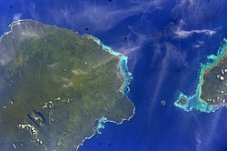
فآسالیلیاگا
| ضلع | |
 | |
 Map of Samoa showing Fa'asaleleaga district | |
| ملک | |
| منطقۂ وقت | -11 |
فآسالیلیاگا (انگریزی: Fa'asaleleaga) سامووا کا ایک administrative territorial entity of a single country جو سامووا میں واقع ہے۔[1]
مزید دیکھیے[ترمیم]
حوالہ جات[ترمیم]
- ↑ انگریزی ویکیپیڈیا کے مشارکین۔ "Fa'asaleleaga"
|
|
