
فائل:False color of Hellas Planitia.jpeg

اس نمائش کا حجم: 486 × 599 پکسلز۔ دیگر تصمیمات: 195 × 240 پکسلز | 389 × 480 پکسلز | 623 × 768 پکسلز | 831 × 1,024 پکسلز | 1,909 × 2,353 پکسلز۔
اصل فائل (1,909 × 2,353 پکسل، فائل کا حجم: 881 کلوبائٹ، MIME قسم: image/jpeg)
خلاصہ
| تفصیل |
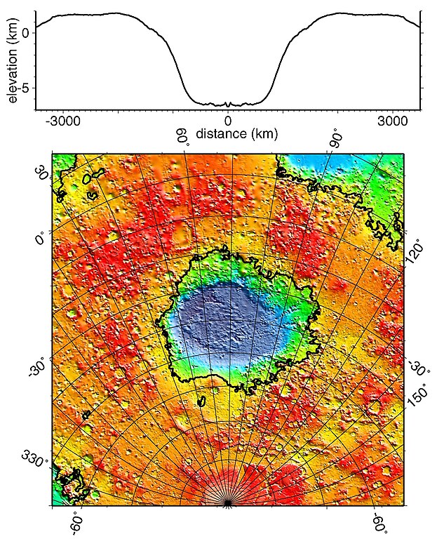
English: Regional topographic model of the Hellas basin (Hellas Planitia) taken by the MOLA instrument aboard the Mars Global Surveyor. (Top) Azimuthally-averaged radial topography used in the calculation of infilling the basin with surrounding material postulated to have been excavated from it. (Bottom) Color-coded topography plotted in an equal-area projection. The black lines correspond to zero-elevation contours. |
| تاریخ | |
| ماخذ | http://photojournal.jpl.nasa.gov/catalog/PIA02033 |
| مصنف | NASA/JPL/GSFC |
اجازہ کاری
| This file is in the public domain in the United States because it was solely created by NASA. NASA copyright policy states that "NASA material is not protected by copyright unless noted". (See Template:PD-USGov, NASA copyright policy page or JPL Image Use Policy.) | ||
 |
Warnings:
|
فائل کا تاریخچہ
کسی خاص وقت یا تاریخ میں یہ فائل کیسی نظر آتی تھی، اسے دیکھنے کے لیے اس وقت/تاریخ پر کلک کریں۔
| تاریخ/وقت | تھمب نیل | ابعاد | صارف | تبصرہ | |
|---|---|---|---|---|---|
| رائج الوقت | 18:51، 19 دسمبر 2010ء | | 1,909 × 2,353 (881 کلوبائٹ) | Orionist | high res version from original source |
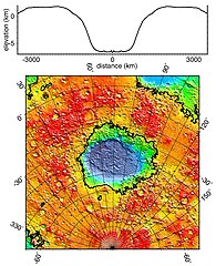
| 23:42، 2 فروری 2006ء |  | 274 × 337 (78 کلوبائٹ) | W-j-s | Hellas Planitia, NASA From [http://rst.gsfc.nasa.gov/Sect19/Sect19_12.html] {{PD-USGov-NASA}} |
روابط
درج ذیل صفحہ اس فائل کو استعمال کر رہا ہے:
فائل کا عالمی استعمال
مندرجہ ذیل ویکیوں میں یہ فائل زیر استعمال ہے:
- als.wikipedia.org پر استعمال
- ca.wikipedia.org پر استعمال
- de.wikipedia.org پر استعمال
- el.wikipedia.org پر استعمال
- en.wikipedia.org پر استعمال
- fr.wikipedia.org پر استعمال
- gl.wikipedia.org پر استعمال
- hy.wikipedia.org پر استعمال
- it.wikipedia.org پر استعمال
- ja.wikipedia.org پر استعمال
- lb.wikipedia.org پر استعمال
- ml.wikipedia.org پر استعمال
- pnb.wikipedia.org پر استعمال
- pt.wikipedia.org پر استعمال
- ro.wikipedia.org پر استعمال
- ru.wikipedia.org پر استعمال
- uk.wikipedia.org پر استعمال
- zh.wikipedia.org پر استعمال