
فائل:Bikini Atoll 2001-01-14, Landsat 7 ETM+, bands 3-2-1-8.png

اس نمائش کا حجم: 800 × 508 پکسلز۔ دیگر تصمیمات: 320 × 203 پکسلز | 640 × 406 پکسلز | 1,024 × 650 پکسلز | 1,280 × 812 پکسلز | 3,063 × 1,944 پکسلز۔
اصل فائل (3,063 × 1,944 پکسل، فائل کا حجم: 9.99 MB، MIME قسم: image/png)
خلاصہ
| تفصیل |
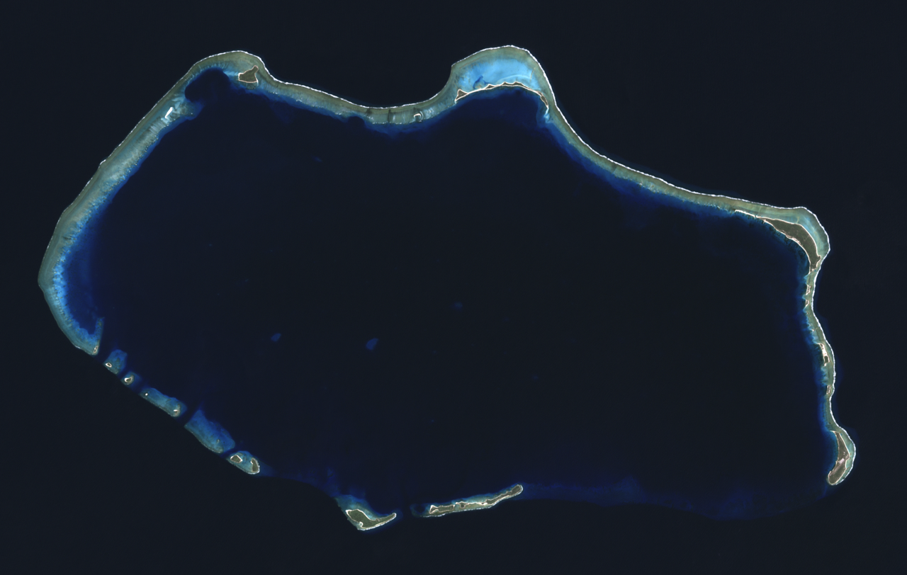
English: Composite "true color" multispectral satellite image of Bikini Atoll, Marshall Islands.
NASA Landsat 7 ETM+ bands used were 3 (red), 2 (green) and 1 (blue), and the image was pan-sharpened to 15m resolution. Imagery courtesy of NASA/USGS. |
| تاریخ | |
| ماخذ | NASA Landsat satellite image GeoTIFF archive, http://glovis.usgs.gov |
| مصنف | NASA |
| Camera location | | View this and other nearby images on: OpenStreetMap |
|---|
اجازہ کاری
| This file is in the public domain in the United States because it was solely created by NASA. NASA copyright policy states that "NASA material is not protected by copyright unless noted". (See Template:PD-USGov, NASA copyright policy page or JPL Image Use Policy.) | ||
 |
Warnings:
|
| Annotations | This image is annotated: View the annotations at Commons |
فائل کا تاریخچہ
کسی خاص وقت یا تاریخ میں یہ فائل کیسی نظر آتی تھی، اسے دیکھنے کے لیے اس وقت/تاریخ پر کلک کریں۔
| تاریخ/وقت | تھمب نیل | ابعاد | صارف | تبصرہ | |
|---|---|---|---|---|---|
| رائج الوقت | 04:22، 24 ستمبر 2012ء | | 3,063 × 1,944 (9.99 MB) | Разрывные | User created page with UploadWizard |
روابط
درج ذیل صفحہ اس فائل کو استعمال کر رہا ہے:
فائل کا عالمی استعمال
مندرجہ ذیل ویکیوں میں یہ فائل زیر استعمال ہے:
- af.wikipedia.org پر استعمال
- ar.wikipedia.org پر استعمال
- ast.wikipedia.org پر استعمال
- bn.wikivoyage.org پر استعمال
- ca.wikipedia.org پر استعمال
- ceb.wikipedia.org پر استعمال
- cs.wikipedia.org پر استعمال
- cy.wikipedia.org پر استعمال
- de.wikivoyage.org پر استعمال
- el.wikivoyage.org پر استعمال
- en.wikipedia.org پر استعمال
- en.wikivoyage.org پر استعمال
- eu.wikipedia.org پر استعمال
- fa.wikipedia.org پر استعمال
- fa.wikivoyage.org پر استعمال
- fr.wikipedia.org پر استعمال
- he.wikipedia.org پر استعمال
- hr.wikipedia.org پر استعمال
- hu.wikipedia.org پر استعمال
- id.wikipedia.org پر استعمال
- ik.wikipedia.org پر استعمال
- incubator.wikimedia.org پر استعمال
- it.wikipedia.org پر استعمال
- lv.wikipedia.org پر استعمال
- ms.wikipedia.org پر استعمال
- ne.wikipedia.org پر استعمال
- pl.wikipedia.org پر استعمال
- ru.wikipedia.org پر استعمال
- sh.wikipedia.org پر استعمال
- sr.wikipedia.org پر استعمال
- tr.wikipedia.org پر استعمال
- uk.wikipedia.org پر استعمال
- vi.wikipedia.org پر استعمال
- www.wikidata.org پر استعمال
- zh.wikivoyage.org پر استعمال