"نیوزی لینڈ میں شہروں کی فہرست" کے نسخوں کے درمیان فرق
حذف شدہ مندرجات اضافہ شدہ مندرجات
کوئی خلاصۂ ترمیم نہیں |
کوئی خلاصۂ ترمیم نہیں |
||
| سطر 1: | سطر 1: | ||
'''نیوزی لینڈ میں شہر''' {{دیگر نام|انگریزی=Cities in New Zealand}} کی معنی 1989ء کے مقامی حکومت کی اصلاحات کے بعد وجود میں آئے۔ |
'''نیوزی لینڈ میں شہر''' {{دیگر نام|انگریزی=Cities in New Zealand}} کی معنی 1989ء کے مقامی حکومت کی اصلاحات کے بعد وجود میں آئے۔ |
||
== شہری علاقے بلحاظ آبادی == |
|||
{| class="sortable wikitable" |
|||
!Rank |
|||
!Urban area |
|||
!Population |
|||
!Area <br />(km²)<ref>{{Cite web|url=http://www.stats.govt.nz/Publications/StandardOfLiving/housing-statistics/freedom-from-crowding.aspx|archive-url=https://archive.is/20120911190954/http://www.stats.govt.nz/Publications/StandardOfLiving/housing-statistics/freedom-from-crowding.aspx|dead-url=yes|archive-date=11 September 2012|title=Freedom from Crowding: Living Density Table 1|publisher=Statistics New Zealand|accessdate=28 January 2010}} (Areas are based on 2001 boundaries. Water bodies of areas greater than 15 hectares are excluded)</ref> |
|||
!Population <br />density (per km²) |
|||
!class="unsortable" | Notes |
|||
|- |
|||
| 1 |
|||
| [[آکلینڈ]] |
|||
| align=right | {{Number table sorting|{{formatnum:{{NZ population data|Auckland|y}}|R}}}} |
|||
| align=right | {{Number table sorting|1086}} |
|||
| align=right | {{Number table sorting|{{Decimals|{{formatnum:{{NZ population data|Auckland|y}}|R}}/1086|1}}}} |
|||
| |
|||
|- |
|||
[[File:Auckland-skyline.jpg|thumb|right|200px|[[آکلینڈ]], the largest city in New Zealand]] |
|||
| 2 |
|||
| [[ویلنگٹن]] |
|||
| align=right | {{Number table sorting|{{formatnum:{{NZ population data|Wellington|y}}|R}}}} |
|||
| align=right | {{Number table sorting|444}} |
|||
| align=right | {{Number table sorting|{{Decimals|{{formatnum:{{NZ population data|Wellington|y}}|R}}/444|1}}}} |
|||
| align=right | 1 |
|||
|- |
|||
[[File:Wellington_at_dawn.jpg|thumb|right|200px|[[ویلنگٹن]], the capital city of New Zealand]] |
|||
| 3 |
|||
| [[کرائسٹ چرچ]] |
|||
| align=right | {{Number table sorting|{{formatnum:{{NZ population data|Christchurch|y}}|R}}}} |
|||
| align=right | {{Number table sorting|608}} |
|||
| align=right | {{Number table sorting|{{Decimals|{{formatnum:{{NZ population data|Christchurch|y}}|R}}/608|1}}}} |
|||
| |
|||
|- |
|||
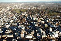
[[File:Hagley Park 01.jpg|thumb|right|200px|[[کرائسٹ چرچ]], the third largest city in New Zealand]] |
|||
| 4 |
|||
| [[ہیملٹن شہری علاقہ]] |
|||
| align=right | {{Number table sorting|{{formatnum:{{NZ population data|Hamilton|y}}|R}}}} |
|||
| align=right | {{Number table sorting|877}} |
|||
| align=right | {{Number table sorting|{{Decimals|{{formatnum:{{NZ population data|Hamilton|y}}|R}}/877|1}}}} |
|||
| align=right | 2 |
|||
|- |
|||
[[File:GardenPlaceHamilton.jpg|thumb|right|200px|[[ہیملٹن، نیوزی لینڈ]]]] |
|||
| 5 |
|||
| [[تائورانگا]] |
|||
| align=right | {{Number table sorting|{{formatnum:{{NZ population data|Tauranga|y}}|R}}}} |
|||
| align=right | {{Number table sorting|178}} |
|||
| align=right | {{Number table sorting|{{Decimals|{{formatnum:{{NZ population data|Tauranga|y}}|R}}/178|1}}}} |
|||
| |
|||
|- |
|||
[[File:Tauranga New Zealand-9833.jpg|thumb|right|200px|[[تائورانگا]]]] |
|||
| 6 |
|||
| [[Napier-Hastings Urban Area|Napier-Hastings]] |
|||
| align=right | {{Number table sorting|{{formatnum:{{NZ population data|Napier-Hastings|y}}|R}}}} |
|||
| align=right | {{Number table sorting|375}} |
|||
| align=right | {{Number table sorting|{{Decimals|{{formatnum:{{NZ population data|Napier-Hastings|y}}|R}}/375|1}}}} |
|||
| align=right | 3 |
|||
|- |
|||
[[File:Napier and bay.jpg|thumb|right|200px|[[نیپئر، نیوزی لینڈ]]]] |
|||
| 7 |
|||
| [[ڈنیڈن]] |
|||
| align=right | {{Number table sorting|{{formatnum:{{NZ population data|Dunedin|y}}|R}}}} |
|||
| align=right | {{Number table sorting|255}} |
|||
| align=right | {{Number table sorting|{{Decimals|{{formatnum:{{NZ population data|Dunedin|y}}|R}}/255|1}}}} |
|||
| |
|||
|- |
|||
[[File:OctagonDunedin.jpg|thumb|right|200px|[[ڈنیڈن]]]] |
|||
| 8 |
|||
| [[پامرسٹن نارتھ]] |
|||
| align=right | {{Number table sorting|{{formatnum:{{NZ population data|Palmerston North|y}}|R}}}} |
|||
| align=right | {{Number table sorting|178}} |
|||
| align=right | {{Number table sorting|{{Decimals|{{formatnum:{{NZ population data|Palmerston North|y}}|R}}/178|1}}}} |
|||
| |
|||
|- |
|||
[[File:PalmerstonNorthSquare1.jpg|thumb|right|200px|[[پامرسٹن نارتھ]]]] |
|||
| 9 |
|||
| [[نیلسن، نیوزی لینڈ]] |
|||
| align=right | {{Number table sorting|{{formatnum:{{NZ population data|Nelson|y}}|R}}}} |
|||
| align=right | {{Number table sorting|146}} |
|||
| align=right | {{Number table sorting|{{Decimals|{{formatnum:{{NZ population data|Nelson|y}}|R}}/146|1}}}} |
|||
| |
|||
|- |
|||
[[File:Nelson New Zealand.jpg|thumb|right|200px|[[نیلسن، نیوزی لینڈ]]]] |
|||
| 10 |
|||
| [[Rotorua]] |
|||
| align=right | {{Number table sorting|{{formatnum:{{NZ population data|Rotorua|y}}|R}}}} |
|||
| align=right | {{Number table sorting|89}} |
|||
| align=right | {{Number table sorting|{{Decimals|{{formatnum:{{NZ population data|Rotorua|y}}|R}}/89|1}}}} |
|||
| |
|||
|- |
|||
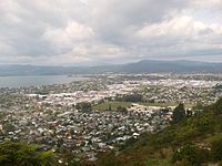
[[File:Rotorua looking south from Mt Ngongotaha.JPG|thumb|right|200px|[[Rotorua]] from Mt. Ngongotaha]] |
|||
| 11 |
|||
| [[فانارئی]] |
|||
| align=right | {{Number table sorting|{{formatnum:{{NZ population data|Whangarei|y}}|R}}}} |
|||
| align=right | {{Number table sorting|133}} |
|||
| align=right | {{Number table sorting|{{Decimals|{{formatnum:{{NZ population data|Whangarei|y}}|R}}/133|1}}}} |
|||
| |
|||
|- |
|||
[[File:Whangarei view from parahki.JPG|thumb|right|200px|[[فانارئی]]]] |
|||
| 12 |
|||
| [[نیو پلایماؤتھ]] |
|||
| align=right | {{Number table sorting|{{formatnum:{{NZ population data|New Plymouth|y}}|R}}}} |
|||
| align=right | {{Number table sorting|112}} |
|||
| align=right | {{Number table sorting|{{Decimals|{{formatnum:{{NZ population data|New Plymouth|y}}|R}}/112|1}}}} |
|||
| |
|||
|- |
|||
[[File:Across New Plymouth to Mt. Taranaki.jpg|thumb|right|200px|[[نیو پلایماؤتھ]]]] |
|||
| 13 |
|||
| [[انورکارگل]] |
|||
| align=right | {{Number table sorting|{{formatnum:{{NZ population data|Invercargill|y}}|R}}}} |
|||
| align=right | {{Number table sorting|123}} |
|||
| align=right | {{Number table sorting|{{Decimals|{{formatnum:{{NZ population data|Invercargill|y}}|R}}/123|1}}}} |
|||
| |
|||
|- |
|||
[[File:Downtown Invercargill, Southland, New Zealand.jpg|thumb|right|200px|[[انورکارگل]]]] |
|||
| 14 |
|||
| [[Whanganui]] |
|||
| align=right | {{Number table sorting|{{formatnum:{{NZ population data|Wanganui|y}}|R}}}} |
|||
| align=right | {{Number table sorting|105}} |
|||
| align=right | {{Number table sorting|{{Decimals|{{formatnum:{{NZ population data|Wanganui|y}}|R}}/105|1}}}} |
|||
| align=right | 4 |
|||
|- |
|||
[[File:Wanganui from Durie Hill.JPG|thumb|right|200px|[[Whanganui]] from Durie Hill]] |
|||
| 15 |
|||
| [[گسبورن، نیوزی لینڈ]] |
|||
| align=right | {{Number table sorting|{{formatnum:{{NZ population data|Gisborne|y}}|R}}}} |
|||
| align=right | {{Number table sorting|85}} |
|||
| align=right | {{Number table sorting|{{Decimals|{{formatnum:{{NZ population data|Gisborne|y}}|R}}/85|1}}}} |
|||
| |
|||
|- |
|||
[[File:Gisborne nz 1.jpg|thumb|right|200px|[[گسبورن، نیوزی لینڈ]]]] |
|||
|} |
|||
== مزید دیکھیے == |
== مزید دیکھیے == |
||
نسخہ بمطابق 10:28، 22 اپریل 2019ء
نیوزی لینڈ میں شہر (انگریزی: Cities in New Zealand) کی معنی 1989ء کے مقامی حکومت کی اصلاحات کے بعد وجود میں آئے۔
شہری علاقے بلحاظ آبادی


| Rank | Urban area | Population | Area (km²)[1] |
Population density (per km²) |
Notes |
|---|---|---|---|---|---|
| 1 | آکلینڈ | 1,628,900 | 1,086 | 1,499.9 | |
| 2 | ویلنگٹن | 418,500 | 444 | 942.6 | 1 |
| 3 | کرائسٹ چرچ | 404,500 | 608 | 665.3 | |
| 4 | ہیملٹن شہری علاقہ | 241,200 | 877 | 275.0 | 2 |
| 5 | تائورانگا | 141,600 | 178 | 795.5 | |
| 6 | Napier-Hastings | 134,500 | 375 | 358.7 | 3 |
| 7 | ڈنیڈن | 122,000 | 255 | 478.4 | |
| 8 | پامرسٹن نارتھ | 86,600 | 178 | 486.5 | |
| 9 | نیلسن، نیوزی لینڈ | 67,500 | 146 | 462.3 | |
| 10 | Rotorua | 59,500 | 89 | 668.5 | |
| 11 | فانارئی | 58,800 | 133 | 442.1 | |
| 12 | نیو پلایماؤتھ | 58,300 | 112 | 520.5 | |
| 13 | انورکارگل | 51,200 | 123 | 416.3 | |
| 14 | Whanganui | 40,900 | 105 | 389.5 | 4 |
| 15 | گسبورن، نیوزی لینڈ | 37,200 | 85 | 437.6 |
مزید دیکھیے
حوالہ جات
- ↑ "Freedom from Crowding: Living Density Table 1"۔ Statistics New Zealand۔ 11 ستمبر 2012 میں اصل سے آرکائیو شدہ۔ اخذ شدہ بتاریخ 28 جنوری 2010 (Areas are based on 2001 boundaries. Water bodies of areas greater than 15 hectares are excluded)
